Coastal flooding is forecast through Saturday afternoon by the National Weather Service.
Moderate coastal flooding is expected. Inundation of 2 to 2.5 feet above ground level is possible along shorelines and low-lying coastal areas.
This is expected to lead to numerous road closures. Low lying property including homes, businesses, and some critical infrastructure may be inundated. Shoreline erosion or damage may occur.
Highest impacts will occur during the late morning high tides Saturday.
Residents in coastal and low-lying areas should stay alert, plan ahead, and monitor local updates.
Stay safe and be prepared.
The South Beach Regional Fire Authority stated, “It looks like the New Year is starting wet and wild.”
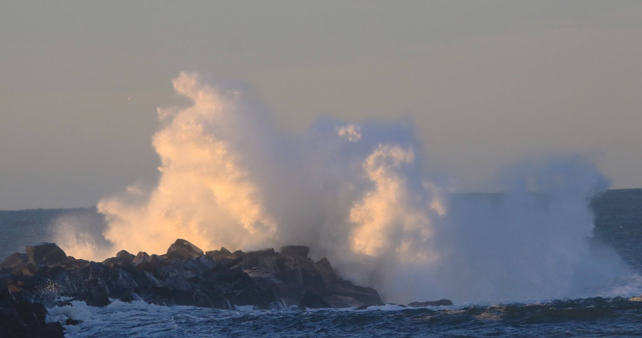
A strong weather system will move through Saturday into Sunday. Periods of steadier lowland rain, breezy winds, as well as higher elevation mountain snowfall are expected. Minor to moderate coastal flooding is forecast, and major coastal flooding is possible along the coast.
Abnormally high astronomical tides will result in an increased risk of coastal flooding through early next week. Pressure, winds, and waves will need to be monitored closely Saturday and Sunday to determine the extent of coastal flooding, but minor to moderate coastal flooding is expected during high tides for all coastlines, with major coastal flooding currently forecast along the coast.
South winds will increase beginning Saturday. Winds are expected to peak in intensity Saturday night into Sunday. There remains uncertainty as to the exact timing and strength of the strongest winds for Western Washington.
Snow levels will range from 3,500 to 4,500 feet later Saturday through early Monday, resulting in higher elevation mountain snowfall accumulation. Another weather system may move through the area later Tuesday into midweek.
Meteorologist Scott Sistek with FOX News states “It’s a perfect storm this weekend … of gravity that is mixing with a regular garden-variety atmospheric storm that will conspire to bring large ‘king tides’ and potential for significant coastal flooding along the Washington coast — and even a bit on the inland waters as well.
“Much of the flooding work is being done by the moon and sun. This weekend represents the full moon which is the time when the sun and moon are aligned to enhance their gravitational effects on our tides. That, of course, happens every month.
“But this month we also have a ‘supermoon’ — as the full moon phase is coinciding with the time when the moon is making its closest orbit to Earth this month (the moon’s orbit is elliptical so there are times when the moon is slightly closer than others.) With the closer moon, that adds just a little more to the gravitational tug.”
Sunday and Monday also coincides when the Earth’s orbit brings it to its closest point around the Sun. “With tides already running high, that leaves us vulnerable if another agitator comes along to boost the tides even more. Right on cue, here comes another storm,” he said.
Low pressure centers have two effects on tides. Lower atmospheric pressure gently “tugs” on the surface of the water and can help pull sea levels a little higher like a weak, but widespread vacuum.
And storms rolling in off the coast can bring in higher waves and a small “storm surge” as winds push the waters ahead. Usually those two items are insignificant and not really noticeable, but in this case they’re adding just a little more to the already high tides, enhancing the flooding risk.