Flood warnings issued for Chehalis River
Published 1:30 am Tuesday, December 9, 2025
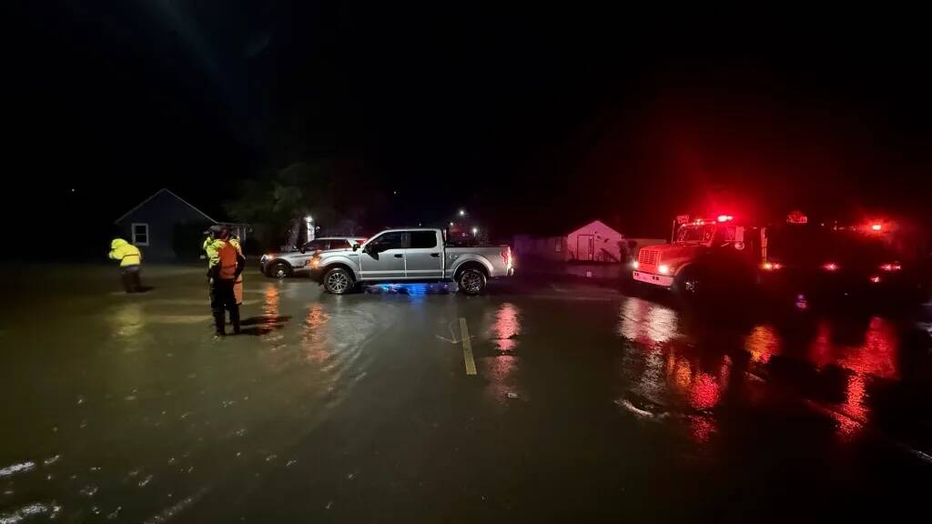


The National Weather Service has issued two Flood Warnings for the Chehalis River above Grand Mound affecting Thurston and Grays Harbor counties Tuesday until further notice, and the Chehalis River at Porter affecting Grays Harbor County through Sunday afternoon.
Chehalis River above Grand Mound:
At 142.5 feet, the Chehalis River in Thurston County will flood several roads in Independence Valley with swiftly moving water including U.S. Highway 12 and James, Independence, Moon and Anderson roads. Flood waters will cut off access to and from the Chehalis Reservation and inundate nearby farmlands. Some residential structures may be threatened.
The river was expected to rise above flood stage (141.0 feet) late Tuesday morning and continue rising to a crest of 142.9 feet late Tuesday evening. It will then rise to 143.6 feet Thursday afternoon. Additional rises are possible thereafter.
Chehalis River at Porter:
At 50 feet the Chehalis River in Grays Harbor will flood numerous farms and roads including U.S. Highway 12. High tidal levels at Aberdeen will worsen flooding along the lower reaches.
The river is expected to rise above flood stage (48.0 feet) Tuesday evening and continue rising to a crest of 50.1 feet early Friday morning.
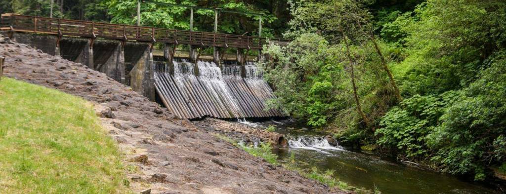
Lake Sylvia dam warning
Grays Harbor County Department of Emergency Management has put out the following alert about the dam at Lake Sylvia in Montesano.
The dam at Lake Sylvia is showing signs of increasing stress. Failure is not occurring at this moment (Tuesday) but could continue to worsen if weather conditions persist. Downstream residents in the Montesano Sylvia Creek areas should be prepared for excessive additional flooding and to take action on short notice. Residents should stay off all trail systems leading to Lake Sylvia.
Additional alerts will be broadcasted if conditions change.
On June 23, State Parks lowered the level of Lake Sylvia approximately five feet to relieve pressure on the Lake Sylvia dam.
The Lake Sylvia dam, which was built around 1918, is showing signs of age and requires maintenance work.
A short break
A temporary break from the heaviest rain Tuesday morning will take place across most of Washington as the atmospheric river has shifted south. The next surge of moisture arrives later today into Wednesday, with rivers crests even higher Wednesday night
Relief for livestock
The Grays Harbor County Fairgrounds is available as an emergency evacuation center if needed — with space for livestock.
Wind
High winds are expected through 8 p.m. Wednesday for the towns of Ocean Shores, Quinault, Hoquiam,
Forks,Westport, Seattle, La Push, Queets, McCleary, Aberdeen, Amanda Park, Pe Ell, Humptulips and Elma.
Expect winds from 20 to 30 miles per hour with gusts up to 40 miles per hour. Gusty winds could blow around unsecured objects. Tree limbs could be blown down and a few power outages may result.
Floods
A flood watch remains in effect through Friday afternoon for Grays Harbor.
Flooding caused by excessive rainfall continues to be possible for rivers, creeks, streams, and other low-lying and flood-prone locations.Flooding may occur in poor drainage and urban areas. Storm drains and ditches may become clogged with debris. Area creeks and streams are running high and could flood with more heavy rain.
An atmospheric river will continue to impact the area through much of the week and bring periods moderate to heavy rain to the region. Sharp rises are expected on area rivers, especially those flowing off the Olympics and Cascades.
Landslides
Rainfall of up to 8 inches over the past several days has increased soil moisture to high levels across Western Washington.
Heavy rainfall of 1 to 5 inches across the lowlands and 4 to 10 inches over the Olympics and Cascades is expected through late Wednesday. Wet and unsettled conditions are also favored to continue through the rest of the week.
This amount of rain will put extra pressure on soil instability, leading to an increased threat of landslides and debris flows, especially from recent burned areas.
A mudslide has already been reported along I-90 Monday evening near
North Bend, causing closures. More landslides are possible.
Areas most susceptible to landslides debris flows under these conditions are steep coastal bluffs, other steep hillsides or road cuts, and recent burned areas. A diminishing threat of landslides and debris flows will continue for several days after the rain ends.