Before you gather with family and friends for a heaping helping of Thanksgiving goodness, you’ve got to get to the table first.
After a bit of light precipitation Monday afternoon, the lowlands around Western Washington forecast some rain during the day Tuesday, National Weather Service meteorologist Steve Reedy said. Rain could still be in the cards for Wednesday and Thursday.
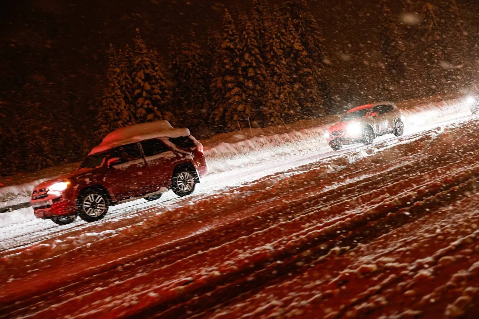
But if you’re going over the mountain passes, Reedy said, “If you have the chance to leave early, I would do that now as opposed to waiting.”
Precipitation in the Cascades passes will look like rain on Tuesday, but come Wednesday, it could look like “significant snowfall” in the form of 6 or more inches, he said. NWS did say the warmer weather means snow levels could rise.
If you’re heading east on Interstate 90 from North Bend to Cle Elum, traffic likely will be congested between around 11 a.m. and 4 p.m. on Wednesday and midday Friday, the Washington State Department of Transportation projects. Traffic westbound will be worst midday Wednesday and during the day on the weekend.
Peak traffic times on Interstate 5 last even longer.
Expect the worst traffic on southbound I-5 between Tacoma and Lacey from about 9 a.m. to 4 p.m. Wednesday through Monday with the least congestion on Thanksgiving Day, WSDOT said. Northbound, expect much the same from about 10 a.m. to 5 p.m. daily.
Going from Bellingham to the Canadian border, traffic is expected to be worst on northbound I-5 on Wednesday and Friday from about 10 a.m. to 5 p.m., with a break Thursday and during the early afternoon Saturday, Sunday and Monday. Southbound traffic will be worst between 9 a.m. and 11 a.m. on Wednesday and Friday, and midday on the weekend.
Traffic on Highway 2 between Skykomish and Stevens Pass will likely be worst going eastbound midday Friday and Saturday. Westbound, it’ll be the worst Saturday afternoon and late Sunday morning.
Here comes the rain, snow, flooding
A stronger and longer lasting weather system moved into Western Washington late Tuesday, with continued precipitation at times through Thursday. The forecast storm total precipitation is 2 1/2 to
4 inches for the Olympics but there remains uncertainty among forecast models.
Snow levels will rise to 5,500 to 6,500 feet by late Wednesday meaning the precipitation will fall as rain. Soil moisture is at normal mid winter saturation levels as well. All of this points to the potential for flooding on the Skokomish River in Mason County by early Thursday. Current river forecasts indicate a crest
on the Skokomish right around flood stage.
— The Seattle Times contributed to this article.