
The Grays Harbor County Board of Commissioners convened a special meeting late Wednesday morning and declared a county-wide emergency due to the current atmospheric river events and associated heavy rain, flooding and erosion in the region.
“The purpose of this meeting is to discuss the issues we’re having related to flooding in the area, within the county as well as within the cities,” said Vickie Raines, District 3 commissioner.
Deputy Director of Emergency Management for Grays Harbor County, Hannah Cleverly, provided a staff report and discussed what has been happening in and around the Grays Harbor area.
“Over the past week or so Grays Harbor County has experienced astronomically high tides, and compounded with excessive 48-hour rainfall has resulted in flooding in the last 36,” Cleverly said. “A series of atmospheric rivers has led to localized erosion, county-wide closures, landslides, significant flooding of rivers and has impacted the stability of the Lake Sylvia Dam. This has resulted in the activation of the Lake Sylvia Dam emergency action plan by the Washington State Parks and Recreation Commission. Additionally, Grays Harbor County has activated its emergency operations center in support of the Lake Sylvia Dam emergency, erosion on our shoreline, and flooding impacts in the local community. We are operating a 24/7 hybrid emergency operations center.”
The Commissioners unanimously approved a resolution declaring a county-wide emergency due to excessive rainfall impacts, including widespread flooding, erosion, landslides, and threats to public facilities and infrastructure. … authorizing actions to request and support U.S. Army Corps of Engineers emergency assistance.
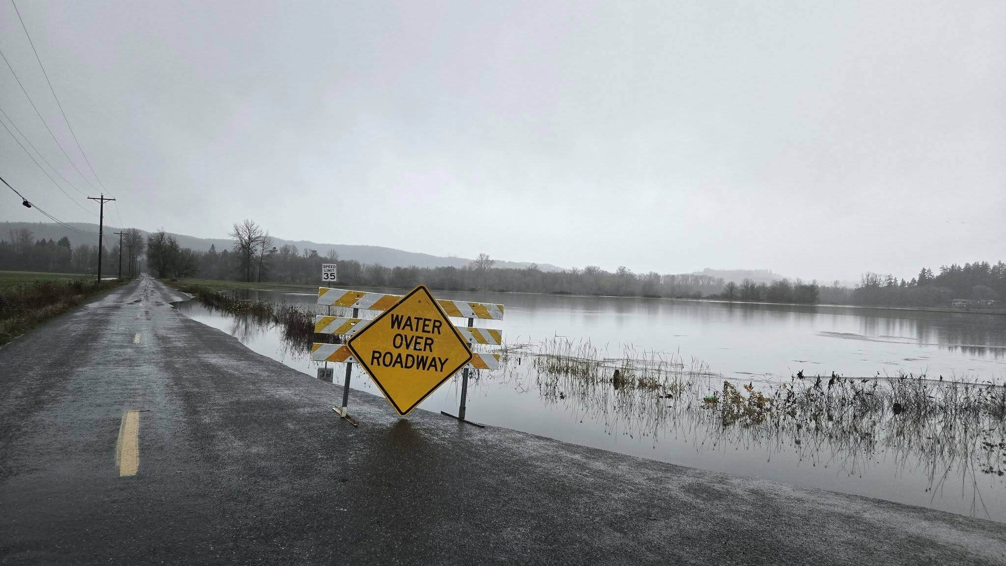
The Flood Warning continues for the Satsop River, and the Chehalis River from Chehalis through Montesano, according to the National Weather Service.
Motorists should not attempt to drive around barricades or drive cars through flooded areas. Turn around, don`t drown when encountering flooded roads. Most flood deaths occur in vehicles.
Satsop River
Through late Thursday evening, at 38 feet, the Satsop River will flood low pasture lands and some roads along the river.
At 10:15 a.m. Wednesday the stage was 37.6 feet. Flood stage is 38 feet. The river was expected to rise above flood stage Wednesday afternoon to a crest of 39.8 feet late this evening. It will then fall below flood stage Thursday evening. This crest compares to a previous crest of 38.9 feet on Dec. 22, 1935.
Chehalis River at Grand Mound
Moderate flooding is occurring and moderate flooding is forecast for the Chehalis River at Grand Mound through Saturday afternoon.
At 142.5 feet, the Chehalis River in Thurston County will flood several roads in Independence Valley with swiftly moving water including U.S. Highway 12 and James, Independence, Moon and Anderson roads. Flood waters will cut off access to and from the Chehalis Reservation and inundate nearby farm lands. Some residential structures may be threatened.
At 9 a.m. Wednesday the stage was 143.1 feet. Flood stage is 141 feet. The river is expected to fall below flood stage Saturday morning and continue falling to 139.8 feet Saturday afternoon.
Chehalis River at Porter into Aberdeen
Forecast flooding changed from Minor to Moderate severity for the Chehalis River at Porter.
Minor flooding is occurring and moderate flooding is forecast until further notice.
At 50 feet, the Chehalis River in Grays Harbor will flood numerous farms and roads including U.S. Highway 12. High tidal levels at Aberdeen will worsen flooding along the lower reaches.
At 5:45 a.m. Wednesday the stage was 48.6 feet. Flood stage is 48 feet.
The river is expected to rise to a crest of 50 feet early Friday morning.
Chehalis River near Montesano
The Chehalis River near Montesano is experiencing high water levels. The High Water Alert stage at Chehalis River near Montesano is set at 12 feet. The highest stage at Chehalis River near Montesano between 2016-2022 was 16.6 feet on Jan. 7, 2022. The maximum recorded elevation, 19.5 feet, was set on 8, 2009.
Flood watch
Flooding caused by excessive rainfall continues to be possible through Friday afternoon for Clallam, Grays Harbor, Island, Jefferson, Kitsap, Mason, San Juan, Skagit, Whatcom, King, Lewis, Pierce, Snohomish and Thurston counties.
Excessive runoff may result in flooding of rivers, creeks, streams, and other low-lying and flood-prone locations. Flooding may occur in poor drainage and urban areas. Storm drains and ditches may become clogged with debris. Area creeks and streams are running high and could flood with more heavy rain.
An atmospheric river will continue to impact the area through much of the week and bring periods moderate to heavy rain to the region. Sharp rises are occurring on area rivers, especially those flowing off the Olympics and Cascades.
