
Thousands of feet above sea level, snow falls on the Olympics, the first flakes in a week that is predicted to see high winds, a king tide, driving rain and temperatures that plunge past freezing toward the weekend.
The coast will experience the worst of the winds, according to meteorologists, though the ocean’s presence will hopefully spare us the worst of the cold.
“We have a fairly strong weather system, a cold front and a low pressure system, offshore,” said Matthew Cullen, a National Weather Service meteorologist, in a phone interview. “This is probably the first storm system of the season that’s like this.”
Beginning Monday night, the county will see six different hazardous weather conditions play out, said deputy director of Grays Harbor Emergency Management Hannah Cleverly. The first alert will be for high winds battering the coast, followed by areas further inland, while blizzard conditions will hammer mountains across the state.
“This series of events that’s happening this week is really impacting all of Western Washington,” Cleverly said. “Western Washington is going to be impacted by one or all of these conditions.”
First there will be wind
Winds are expected from 30 to 50 mph, according to the NWS, with gusts up to 65 mph. Winds are expected to blow down trees and imperil power lines, according to the alert.
The primary risk to residents with wind is debris blown by the gusts and damage to power lines, Cleverly said.
“That can damage property. That can damage trees. That can damage lines,” said Ian Cope, communications director for the Grays Harbor Public Utility District, in an interview. “We build the system to be strong. But the best system is still going to have problems with falling trees.”
Cleverly encouraged people to be ready for power outages, which could be a major effect of high winds. There may also be potential for thunderstorms and hail, Cleverly said.
“Power outages would probably be the most impactful,” Cleverly said. “We encourage people to be ready for potential of power outages.”
Having flashlights and blankets handy, charging up extra power sources ahead of time, and minimizing using the fridge if the power goes down are all good practices, Cleverly said. The Emergency Management department also highly, strenuously encourages people to be safe when using generators, Cleverly said.
“Do not bring your generator into your garage and run an extension cord into your house,” Cleverly said. “Keep your generator a good (distance) from your house.”
High wind warnings are in effect from Monday until Tuesday afternoon.
That is the first day.
Thrash on the coast
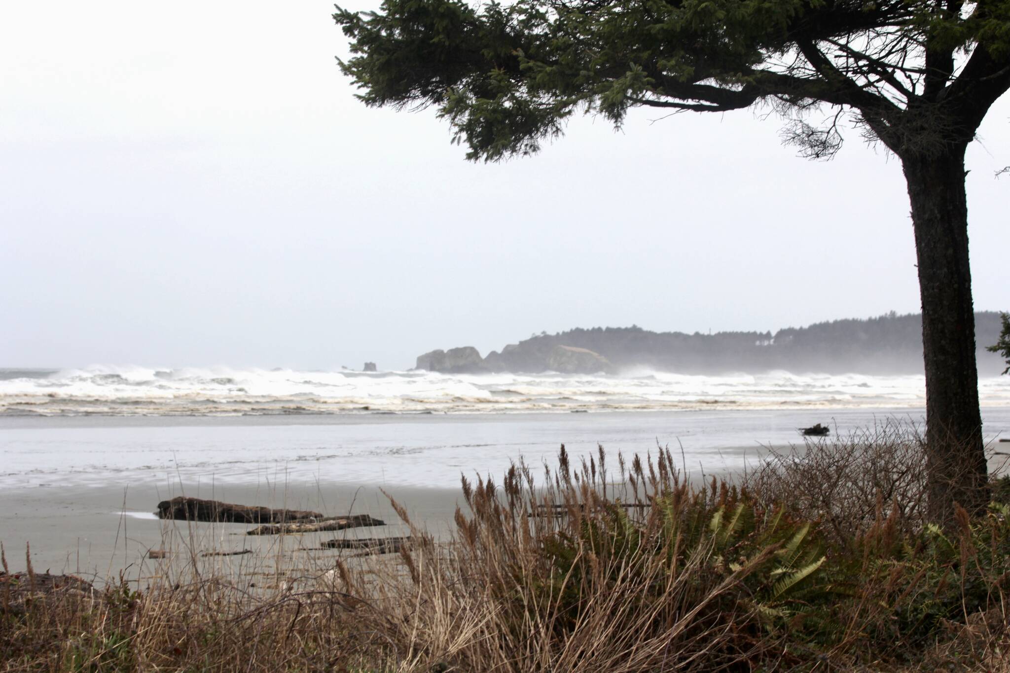
Alongside the high winds, the coast will see an irate sea, with waves as large as 25 to 30 foot swells expected to accompany the highest tides of the month. Powerful waves may cause coastal erosion, damage to infrastructure and flood roadways, Cullen said. Waves can also be deceptively powerful or just apparently powerful, Cleverly said, and being dragged out to sea is a suboptimal way to spend one’s day.
“We encourage people to stay off the beach. Waves are unpredictable,” Cleverly said. “Especially for our coastal communities, stay off the beach and stay out of the hazard zone.”
Along with rain and possible flooding in the lowlands, Cleverly reminded drivers not to drive flooded roads; many drownings in floods come as a result of attempting risky roads.
“With the rain in the lowlands, (there’s) the ponding of water,” Cullen said. “Never drive through flooded roadways.”
There may also be downed power lines or other debris concealed under the dark waters.
Coastal flood warnings are in effect from the morning of Tuesday until the afternoon, with high surf warnings in effect till Wednesday morning.
That is the second day.
That which survives must Freeze
Toward the end of the week, temperatures may drop, Cleverly said.
“It’s gonna go from the wet and windy to cold and snowy later in the week,” Cope said. “I’d say this is the first major event we’ve seen this year where we could see some prolonged weather event that affects the system.”
Evening temperatures could reach into the 20s, Cleverly said, though meteorologists will have a better idea closer to the weekend of what to expect.
“As we reach into the remainder of the week, cold temperatures will start to come in, with below normal temperatures over the weekend. There’s a small percent chance of snow on Thursday. On Friday the probability increases,” Cleverly said. “On the tail of the end, when things start to potentially warm up, we may have freezing rain potential at the end of the weekend.”
The confidence in the late-week conditions will firm up closer to the weekend, Cleverly said.
“Freezing rain can always weigh on power lines and tree limbs,” Cleverly said. “If you don’t have to go out, don’t go out. Stay home. Play with your kids in the snow.”
In the event of outages, the department is monitoring the situation and is prepared to respond as residents require, Cleverly said.
“We are monitoring throughout the week and into the weekend. We encourage people to sign up for our alerts,” Cleverly said. “It’s a way to be notified of hazards that may impact you.”
Stay in, be safe
Staying home if the weather’s bad is always a good idea, Cleverly said, not exposing yourself to extra risk.
Grays Harbor PUD will post outages on its social media accounts, Cope said. PUD can be contacted to report outages at 360-537-3721.
“The crews respond when the lines go down good weather or bad,” Cope said. “Our crews go out on a fairly regular basis in situations like this. They’re well trained and get things done to get it restored as quickly as they can.”
A little common sense is all that’s needed to make it through severe weather unbothered, Cleverly said.
“This is the first event of the season. Dust off those emergency preparedness supplies,” Cleverly said. “Sign up for Grays Harbor County emergency alerts. Be careful and stay safe.”
Contact Senior Reporter Michael S. Lockett at 757-621-1197 or mlockett@thedailyworld.com.
