Moderate flooding hits Satsop River
Published 1:30 am Thursday, December 19, 2024
A Flood Watch remains for Hoquiam and Aberdeen through late Thursday night, according to the National Weather Service.
Excessive rainfall continues to be possible throughout Grays Harbor. Excessive runoff may result in flooding or rivers, creeks, streams and other low-lying and flood-prone areas.
A combination of heavy rainfall that ended Wednesday morning plus additional rainfall from multiple storm systems impacting the region this week may drive the lower Chehalis River near flood stage.
The Weather Service states you should monitor later forecasts. Those living in areas prone to flooding should be prepared to take action should flooding develop.
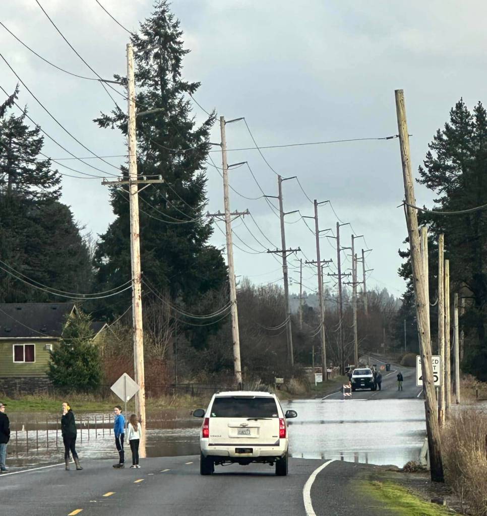
Observed flooding changed to moderate severity and increased in duration for the Satsop River near Satsop. Heavy rain has ended, however rivers continue to rise, pushing the Satsop into moderate flooding.
Motorists should not attempt to drive around barricades or drive cars through flooded areas. Turn around, don’t drown when encountering flooded roads. Most flood deaths occur in vehicles.
At 11:15 a.m. Wednesday the flood level on the Satsop River was at 40 feet. At that level, the Satsop River will flood, inundating farms, roads and some residential areas. Erosion will likely damage some areas along the river. At 11:15 a.m. Wednesday the stage was 40.0 feet.
The river was forecast on Wednesday afternoon to continue to rise a few more hours and crest in moderate flood stage around 40.1 feet. The river was expected to fall below flood stage Thursday morning and continue falling to 34.6 feet late Friday morning.
In addition, a small craft advisory was placed through Thursday morning for portions of Pacific coastal waters off of Grays Harbor. Conditions will be hazardous to small craft. A small craft advisory means seas 10 feet or higher are expected to produce hazardous wave conditions to small craft. Inexperienced mariners, especially those operating smaller vessels should avoid navigating in these conditions.
Historic crests of the Satsop River at Satsop:
42.79 feet — Jan. 22, 1935
41.77 feet — Jan. 12, 2022
41.23 feet — Jan. 7, 2022
40.01 feet — Jan. 3, 2021
39.65 feet — Jan. 12, 2001
This follows a storm that hit Grays Harbor Tuesday night, knocking out power across Grays Harbor County. Wind speeds in Hoquiam included a gust of 66 mph Tuesday night.
The next system will arrive Thursday into Friday with gusty south winds, the National Weather Service said.
The West Coast is expecting a break in the storms in the middle of the week this week, but at least two more storms are lining up to hit the West Coast over the weekend and early next week, with a wet weather pattern expected for the Pacific Northwest up until Christmas.
Weather patterns also are hinting at another atmospheric river that could hit on Christmas Day, although there’s uncertainty with the storm’s timing and strength.