Site Logo

Checking in on the Chehalis Basin restoration projects

Published 1:30 am Friday, January 16, 2026

Andrea Watts / The Daily World
In summer of 2023, the middle fork Wildcat Creek had three fish passage barrier corrections on Summit Road, Elma Hicklin Road, and County Line Road. Instead of flowing through culverts, the creek now flows under pre-cast concrete bridges. On County Line Road, flooding over the roadway occurred often enough that the county flagged it as needing fixing because of ongoing maintenance issues. A visual sign that a restoration project is achieving its goals is how the water is flowing. Basically, you make sure the water is going through at a slow enough rate for the juveniles and the water is not narrowed up and shooting right through, said Lonnie Crumley, chair of the nonprofit Chehalis Basin Fisheries Task Force. When the steam flowed through the culverts, the higher stream velocity negatively affected the substrate transport. The narrowed channel passage also caused the water to flood upstream. As a result of the barrier correction, “everything’s getting back into a natural system,” said co-owner of Streamworks Consulting Brett Demond. The section of creek that flows under Summit Road showed signs that the creek overtopped its banks and flooded into the grassy field, but not nearly the extent as it had in previous years. “This whole field here would go underwater ,” Crumley said, and cDemond added, “so it’s really reduced the flooding, but it’s still connected to the floodplain.” Another visual sign that the restoration is successful is that you aren’t seeing any fish moving through, which does seem counter intuitive. “Everybody always complains when they come, they don’t see any fish, but that’s the whole point,” said Crumley. “We don’t want them building up here. We want them going on through.” Crumley points out a section of gravel that appears brighter colored than the surrounding gravel. “That’s probably a redd right in there,” he said. A redd is where a female salmon has laid her eggs, and digging in the gravel cleans it. On County Line Road, the bridge also replaced three pipes, and the stream is “now acting like a normal stream” Demond said. Looking over the edge of the bridge, Crumley observed, “Not too many shiny spots here.” Downstream of the bridge is an active beaver pond.
1/5

Andrea Watts / The Daily World

In summer of 2023, the middle fork Wildcat Creek had three fish passage barrier corrections on Summit Road, Elma Hicklin Road, and County Line Road. Instead of flowing through culverts, the creek now flows under pre-cast concrete bridges. On County Line Road, flooding over the roadway occurred often enough that the county flagged it as needing fixing because of ongoing maintenance issues. A visual sign that a restoration project is achieving its goals is how the water is flowing. Basically, you make sure the water is going through at a slow enough rate for the juveniles and the water is not narrowed up and shooting right through, said Lonnie Crumley, chair of the nonprofit Chehalis Basin Fisheries Task Force. When the steam flowed through the culverts, the higher stream velocity negatively affected the substrate transport. The narrowed channel passage also caused the water to flood upstream. As a result of the barrier correction, “everything’s getting back into a natural system,” said co-owner of Streamworks Consulting Brett Demond. The section of creek that flows under Summit Road showed signs that the creek overtopped its banks and flooded into the grassy field, but not nearly the extent as it had in previous years. “This whole field here would go underwater ,” Crumley said, and cDemond added, “so it’s really reduced the flooding, but it’s still connected to the floodplain.” Another visual sign that the restoration is successful is that you aren’t seeing any fish moving through, which does seem counter intuitive. “Everybody always complains when they come, they don’t see any fish, but that’s the whole point,” said Crumley. “We don’t want them building up here. We want them going on through.” Crumley points out a section of gravel that appears brighter colored than the surrounding gravel. “That’s probably a redd right in there,” he said. A redd is where a female salmon has laid her eggs, and digging in the gravel cleans it. On County Line Road, the bridge also replaced three pipes, and the stream is “now acting like a normal stream” Demond said. Looking over the edge of the bridge, Crumley observed, “Not too many shiny spots here.” Downstream of the bridge is an active beaver pond.

Andrea Watts / The Daily World
In summer of 2023, the middle fork Wildcat Creek had three fish passage barrier corrections on Summit Road, Elma Hicklin Road, and County Line Road. Instead of flowing through culverts, the creek now flows under pre-cast concrete bridges. On County Line Road, flooding over the roadway occurred often enough that the county flagged it as needing fixing because of ongoing maintenance issues. A visual sign that a restoration project is achieving its goals is how the water is flowing. Basically, you make sure the water is going through at a slow enough rate for the juveniles and the water is not narrowed up and shooting right through, said Lonnie Crumley, chair of the nonprofit Chehalis Basin Fisheries Task Force. When the steam flowed through the culverts, the higher stream velocity negatively affected the substrate transport. The narrowed channel passage also caused the water to flood upstream. As a result of the barrier correction, “everything’s getting back into a natural system,” said co-owner of Streamworks Consulting Brett Demond. The section of creek that flows under Summit Road showed signs that the creek overtopped its banks and flooded into the grassy field, but not nearly the extent as it had in previous years. “This whole field here would go underwater ,” Crumley said, and cDemond added, “so it’s really reduced the flooding, but it’s still connected to the floodplain.” Another visual sign that the restoration is successful is that you aren’t seeing any fish moving through, which does seem counter intuitive. “Everybody always complains when they come, they don’t see any fish, but that’s the whole point,” said Crumley. “We don’t want them building up here. We want them going on through.” Crumley points out a section of gravel that appears brighter colored than the surrounding gravel. “That’s probably a redd right in there,” he said. A redd is where a female salmon has laid her eggs, and digging in the gravel cleans it. On County Line Road, the bridge also replaced three pipes, and the stream is “now acting like a normal stream” Demond said. Looking over the edge of the bridge, Crumley observed, “Not too many shiny spots here.” Downstream of the bridge is an active beaver pond.
Andrea Watts / The Daily World
In 2018, the removal of five culverts on Sand Creek, which is southwest of McCleary, opened over eight miles of spawning and rearing habitat for five salmonid species. “We did see Coho going through here the first year it was done, that was cool,” co-owner of Streamworks Consulting Brett Demond said. Lonnie Crumley, chair of the nonprofit Chehalis Basin Fisheries Task Force, added, “Now I’ve seen Chinook in this stream.” Eight years after the project’s completion, some of the planted trees have been overtaken by the blackberries. The vegetation along the bank shows signs of the stream flooding but no higher than Demond has observed in previous years.
Andrea Watts / The Daily World
The three barrier culverts on Bush Creek that were also removed in 2018 opened nearly 8.5 miles of upstream stream spawning and rearing habitat for the five salmonoid species found in the creek. Two of the barrier culverts were replaced with 29-foot diameter pipes instead of a bridge because installing bridges would have been too costly. In this area too, the smaller sized culverts caused the water to back up under heavy flows and flood the surrounding area. Now, the water is flowing through. The planted western redcedar, willow and Douglas-fir are growing well. And cutthroat are in the stream. After we opened the pipe and had water running through it, co-owner of Streamworks Consulting Brett Demond said, there was probably a dozen cutthroat hanging out in it.
Andrea Watts / The Daily World
Replacing the 6.5-foot-diameter culvert underneath Schafer Boom Road, through which Camp Creek flowed, is the most recent project completed by the Chehalis Basin Fisheries Task Force in summer 2025. The creek now flows under a brand-new 39-foot-long bridge. Other changes made to the area was straightening the channel so it would have a straight approach to the bridge; the old channel now provides overflow when the stream is running high and off-channel rearing habitat. In that little channel there’s a pretty good flow through there even in the summer, because there’s water that comes in from all over the place here, said Lonnie Crumley, chair of the nonprofit Chehalis Basin Fisheries Task Force. In the channel are logs with root wads, and their placement is deliberate, to prevent erosion and provide habitat for the juvenile salmonoids.
Andrea Watts / The Daily World
Although the banks of Camp Creek are lacking vegetation now, after the planting party scheduled for Feb. 7, the bank will be filled with willow, red osier dogwood, and spruce, Douglas-fir, and western redcedar seedlings. On the other side of the bridge, the creek channel has also responded to the increased flow.

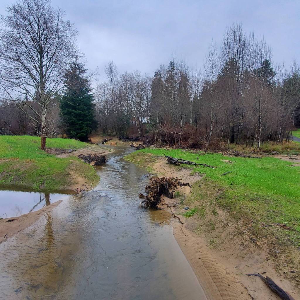
A little over 21 inches of precipitation is what National Centers for Environmental Information, an agency within the National Oceanic and Atmospheric Administration, reported that Grays Harbor County received in December 2025. The county’s historic average for the month is 15 inches, which meant that the streams, rivers, and stormwater systems were handling higher flows of water.

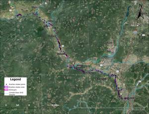
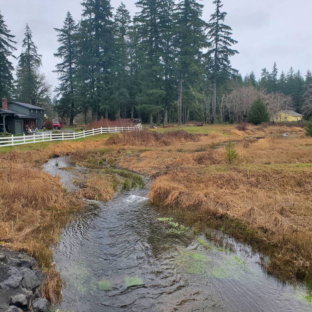
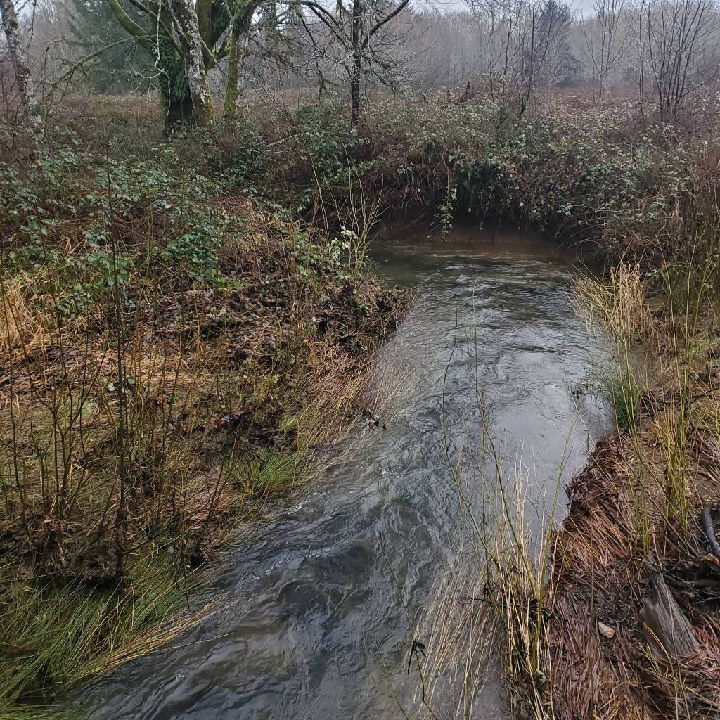
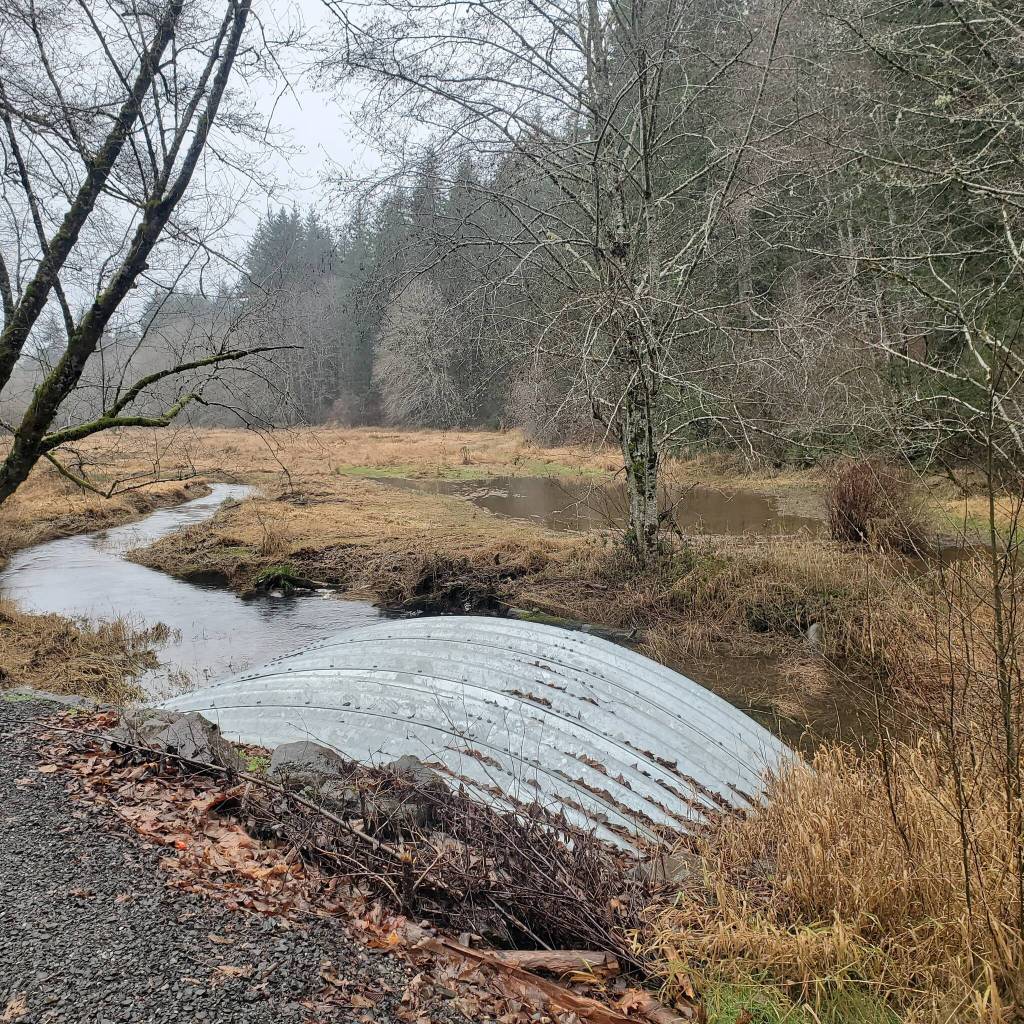
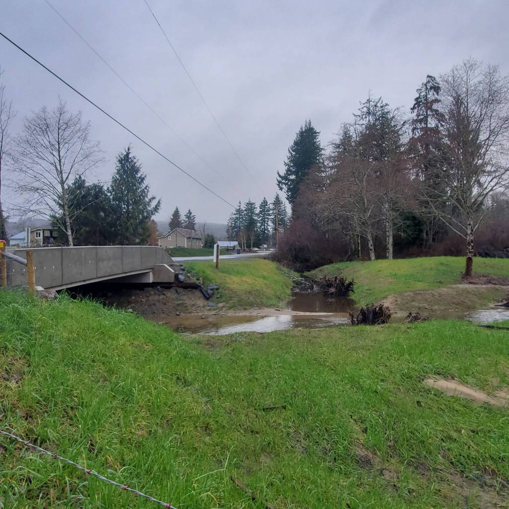
In early January, Lonnie Crumley, chair of the nonprofit Chehalis Basin Fisheries Task Force (CBFTF) and co-owner of Streamworks Consulting with his wife, Brett Demond, took The Daily World on a site visit of restoration projects in east Grays Harbor County to see how the fish passage projects handled the higher stream flows.

Through their work with the CBFTF, Crumley and Demond have overseen fish barrier removal projects on streams and creeks within the county that are likely only familiar to the locals because they are away from the main roads. For Demond, a takeaway over the course of being involved with the CBFTF has been seeing “how important the tributaries are. A lot of emphasis is given on the main stems, but the tributaries are the rearing habitat, the spawning habitat. The main stems are transportation for the most part.”

Of the fish barrier projects accomplished thus far, “we’ve got a lot of the major ones [done], and the ones that are left are pretty expensive,” Demond said.

This summer, CBFTF will begin work on replacing a culvert at the mouth of Damon Creek under Kirkpatrick County Road, which is two miles east of Copalis Crossing. The restoration project also includes adding a boat ramp for safer recreational fishing and boating access on the Humptulips River. Following this culvert’s replacement, nearly six miles of spawning and rearing habitat will be accessible to Chinook, chum salmon, and steelhead that are found in the river. Funding for the project is being provided by the Washington Recreation and Conservation Office with matching funds by the CBFTF.

On Feb. 7 from 10 a.m. to noon, CBTF and Grays Harbor Stream Team are hosting a planting party at the Camp Creek restoration project along Schafer Boom Road. Driving directions: Take Simmons Road exit off U.S. Highway 12 and immediately turn right paralleling U.S. Highway 12. Take first country road left onto Schafer Boom Road and park along the road just past the bridge. For questions, contact bdowns@graysharborcd.org