
By David Gutman
The Seattle Times
We have polls to try to gauge public opinion. We have models to forecast atmospheric conditions.
Sometimes they’re wrong.
Just as pollsters sometimes fail to correctly predict elections, weather and atmospheric models over the weekend failed to forecast the staying power of the wildfire smoke that’s cloaked Washington in a noxious haze for the past four days and now looks likely to hang on for another four.
As recently as Sunday, officials thought the smoke would start clearing out on Monday. Now, it looks like it won’t be until the end of the workweek.
There are two reasons for the smoke’s obstinance: The meteorological forecasts predicted a weather system blowing in from the Pacific coast late Sunday and into Monday, bringing rain and wind, and dispatching the smoke. Instead, the system mostly petered out. And the atmospheric models that predict how the weather will affect the air mostly failed to account for the physical effects of the smoke itself.
The smoke is making temperatures cooler than they would otherwise be, which, in turn, may be helping the smoke linger.
“Originally, we had a good front forecasted to come through today, but it’s not coming through as fast we thought,” said Mary Butwin, a meteorologist with the National Weather Service in Seattle. “We were expecting a lot heavier rainfall, as well as for the system to move over land much faster than what’s actually happening.”
The atmospheric models used to determine how the weather will affect the air quality consider a multitude of variables, things like temperature, moisture, barometric pressure, wind speed, terrain, urban areas and altitude, said Ranil Dhammapala, an atmospheric scientist with the state Department of Ecology.
But the models didn’t consider the layer of smoke.
“It’s doing a lot of calculations for you, but what matters to us in a situation like this is how well is the wind going to come and clear the smoke at the ground level,” Dhammapala said. “It didn’t take into account a reduced amount of heating at the surface and painted an overly optimistic picture of the clearing.”
The smoke is contributing to a temperature inversion, where temperatures at ground level are cooler than they are higher in the atmosphere, the opposite of what normally occurs.
As sunlight comes into the atmosphere, some of it is being reflected and absorbed by the smoke layer, preventing heat from reaching the surface. But unlike a cloud layer that also prevents heat from reaching the surface, the smoke doesn’t stop heat-producing radiation from escaping the earth’s surface. Less heat coming down and more heat going up has led to temperatures as much as 20 degrees warmer at higher elevations.
“We’ve got this smoke layer sitting above us and it’s upsetting the radiation balance between the incoming and outgoing radiation,” Dhammapala said.
The inversion can also make it more difficult for the air at different altitudes to mix, said Rob Wood, a professor of atmospheric sciences at the University of Washington, meaning the smoke is less likely to get diluted.
“It’s that heating of the surface that often drives the mixing process,” Wood said. “If you prevent the stirring of the atmosphere, it could potentially have delayed the mixing out of the smoke.”
Gregory Hakim, also a UW professor of atmospheric sciences, said that sunshine hitting the earth’s surface acts like a flame under a pot of boiling water — the heat causes activity that mixes up the air above it.
“If you don’t have a lot of wind causing the mixing and you don’t have a lot of sun,” Hakim said, “everything’s just kind of stagnant and trapped near the surface.”
UW runs more than a dozen different weather models to try to predict how the air will move through various geographies. The state had largely been looking at the model called High-Resolution Rapid Refresh, which had been more optimistic than most. Monday’s forecast switched to a different model, Dhammapala said, one closer to the average of all the models.
“The big key of getting the smoke away from the surface is to mix it vertically,” Hakim said “When the winds are really light, these forecast models are not very good at that mixing.”
“Get ready to live with it for a while,” Hakim said.
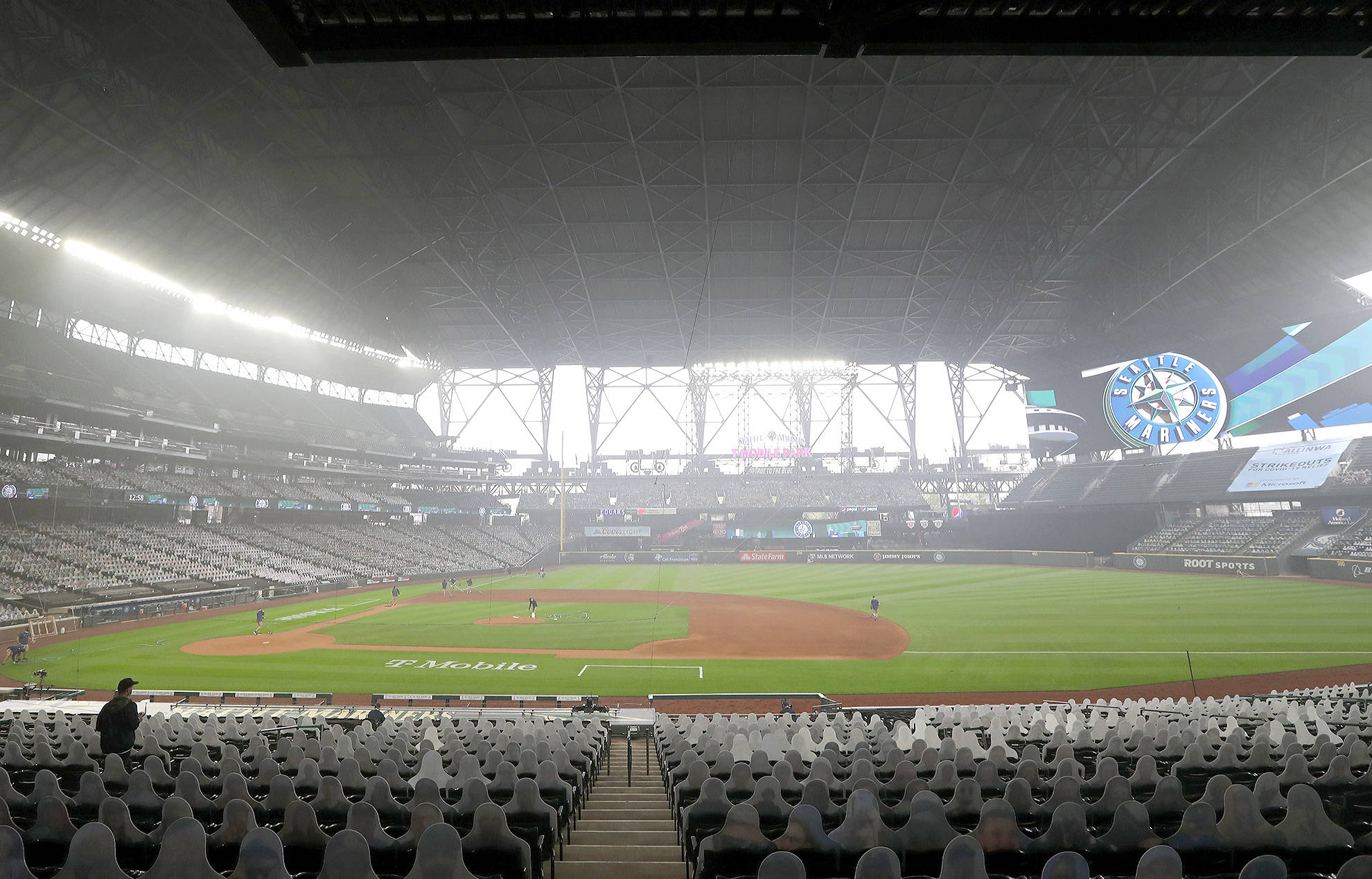
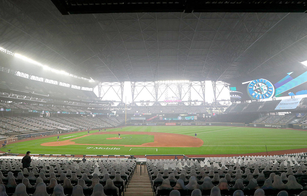
It’s hazy — even with the roof closed — as the field is prepared for the Seattle Mariners to play the Oakland Athletics in the first game of a doubleheader on Monday at T-Mobile Park in Seattle. Ken Lambert / The Seattle Times
