After swollen surf chewed the face from a 20-foot-tall sand berm on Ocean Shores’ southern shoreline for the second time in two weeks, officials opted for a firmer tactic to hold off the Pacific Ocean from reaching public infrastructure nearby.
That effort presented a race against the clock this week as king tides loomed Thursday afternoon.
City of Ocean Shores officials met with officials from the U.S. Army Corps of Engineers Wednesday afternoon along with owners of beachfront properties to discuss a plan for emergency erosion protection after saltwater breached a vacant lot and reached a ditch adjacent to nearby Marine View Drive on Tuesday. Ocean Shores Mayor Frank Elduen declared a state of emergency earlier this week to allow the city to bolster the sand berm with small rocks.
A storm surge the week of Jan. 8, combined with heightened tides, brought wave action into the lawns and porches of properties about a half-mile west of the Damon Point trailhead on the southern end of the city of Ocean Shores.
Kim D’Silva, who owns one of the houses in the area, said overtopping waves shifted a boat anchored in her front lawn, and sucked away driftwood she had compiled to buffer the waves. A vacant lot next to D’Silva’s was a low point where the saltwater carried into a ditch near Marine View Drive and through a culvert that connects to the city’s fresh waterway system.
The violent seas also sucked away about half of the sand comprising a 300-foot-long, 30-foot wide berm the city of Ocean Shores in December constructed just east of D’Silva’s house. What’s left of the berm is a 15- to 20-foot-high vertical cliff of sand near a beach access the city recently closed.
The southern shoreline of Ocean Shores has receded by about 3,000 feet in the last four decades, according to a 2023 report commissioned by the city. The city constructed the sand berm as a temporary erosion measure to prevent the ocean from damaging at-risk infrastructure. Officials labeled it a “sacrificial berm.”
But losing half the sand from the berm every high tide — which also occurred earlier in January and was replaced — isn’t sustainable, said Marshall Read, the city’s head planner and shoreline expert.
“The sand berm is doing exactly what it was designed to do, but it was not as durable as I was hoping,” Read said on Wednesday.
“We need to go a little bit harder,” he added.
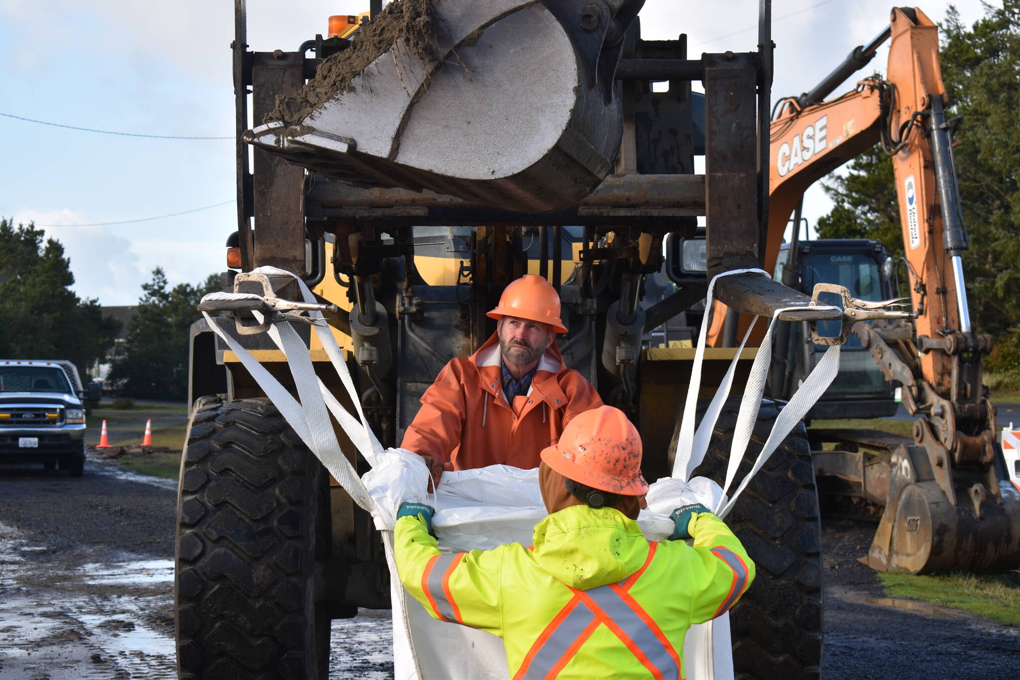
In addition, the vacant lot next to D’Silva’s house — where the berm did not extend previously — now presents the most likely breach spot and a direct path to the city’s nearby water tank. Instead of replacing the berm with only sand for a third time, city crews will add two other materials: sand-filled “super-sacs,” bags about the size of a small couch, as well as mid-sized rounded rocks, or cobble, meant to dissipate wave energy while collecting grains of sand.
The city might build upon the cobble in a future long-term erosion solution, Read said, although further projects still need to be finalized.
The super-sacs were provided by the Army Corps. The city phoned the federal agency on Tuesday afternoon to request technical assistance with the project. Brian Stenehjem, an engineer with the Army Corps, said the agency has typically recommended cobble berms in similar situations as opposed to hard armoring.
“Instead of creating a hard structure that deflects the waves, it absorbs that impact, and also allows sand to be deposited,” Stenehjem said. “It’s kind of a moving wall.”
The berm will extend a few dozen feet further west in front of D’Silva’s house and the empty lot. Read said the project was moving “as fast as we possibly can” to extend the berm in front of the low point before a king tide scheduled for Jan. 11 at 12:03 p.m.
Contact reporter Clayton Franke at 406-552-3917 or clayton.franke@thedailyworld.com.


