Tsunami Road Show: ‘big one’ due any time, preparedness key to survival
Published 1:30 pm Friday, April 13, 2018


Two messages came through strongly at the Tsunami Road Show held at the Ocosta School Wednesday: The “big one” could happen at any moment, and being thoroughly prepared is your best shot at surviving it.
“It really could happen at any time,” said Carrie Garrison-Laney, coastal hazards specialist with the University of Washington’s Washington Sea Grant.
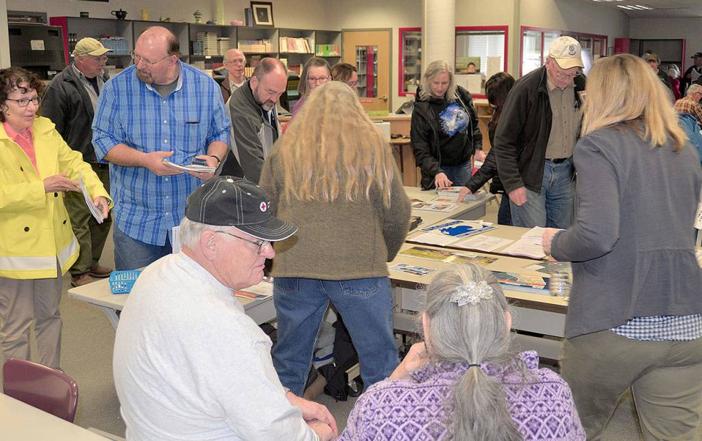
A crowd of close to 100 area residents sat and listened intently to the 90-minute presentation, which involved several state agencies and was hosted by Grays Harbor County Emergency Management deputy director Chuck Wallace. This was one of four presentations held during the week at locations in Grays Harbor and Pacific counties.
History
Garrison Laney talked about the history of major earthquakes along the Cascadia subduction zone, a fault line where the Juan de Fuca plate meets the North America plate offshore. The Juan de Fuca plate is pushed down under the North America plate. Considering there is no evidence of a major quake since 1700, a great deal of pressure has built up in the zone.
“A lot of stress has built up over time since 1700,” said Garrison-Laney. “Eventually it will build up to a big energy release in the form of an earthquake.”
Historical data from tsunami study sites, like one in Discovery Bay in near Port Townsend, shows the plates produce a large quake about every 600 years. There has not been evidence discovered of a tsunami at Copalis, Grays Harbor or Willapa Bay since the 1700 event, suggesting the plates have been building pressure since that event.
Mapping, planning and new tools
Daniel Eungard, subsurface data geoscientist with the Department of Natural Resources’ Geological Survey, said by studying the past we can be better prepared for when the next big one hits.
“By looking at the past we can get an idea of what’s coming and how to prepare,” he said.
He said studies and monitoring of the Cascadia subduction zone show the North America plate rising about a millimeter a year.
“So why worry? A millimeter a year?” asked Eungard. “After hundreds of years that’s building a lot of energy.” When that energy reaches its breaking point it is released in the form of an earthquake.
Eungard went on to explain how mapping of inundation areas and emergency planning has changed in recent years. Researchers now use a “worst-case scenario” model based on a 2,500-year event, a magnitude-9 quake or higher.
“A medium sized event is the most likely scenario, but for emergency planning and critical facilities we want to plan for the 2,500-year event,” he said.
He talked about an important newer tool developed by the Geological Survey, the Geological Information Portal, an interactive online tool allowing individuals to type in any address and find the level of inundation they can expect, and mapped tsunami evacuation routes.
“There’s a draw tool to find evacuation routes from home, school, work,” he said, adding planning escape routes only from home isn’t enough; everyone needs a plan from anywhere they frequent, and a plan that includes reuniting families later. The portal can be accessed at dnr.wa.gov/geologyportal.
The state has also authorized funding to hire a new tsunami modeling coordinator, said Eunger. “The Legislature heard your concerns and now we’re hiring our own modeler for the first time,” he said.
Tsunami warning system
Tyree Wilde is a warning coordination meteorologist for the National Weather Service, based in Portland. He described the system of early warning electronics along the coast and Strait of Juan de Fuca and how warnings and watches are issued.
“There are two tsunami warning centers; the Pacific center in Honolulu and the National center in Palmer, Alaska,” he said. “When a quake occurs, we quickly work to determine what kind of product we want to release.” “Products” include a tsunami warning, meaning there is immediate danger and evacuations are needed; an advisory, meaning strong and dangerous currents are possible and people should stay off the beaches; or a watch, meaning there is potential danger and people need to monitor the situation.
Quakes are detected by a string of sensors on the ocean floor. A buoy attached at the surface can immediately transmit data to the warning centers.
A National Oceanic and Atmospheric Administration weather radio is the best tool for early warnings. “It’s like a smoke detector in your home,” said Wilde, and is the most likely tool to awaken you if the alert comes in the middle of the night. People can also sign up for wireless alerts. “If a cell phone is within five towers (of the emergency area) the four major carriers will automatically send that warning to your wireless devices,” said Wilde.
There are also 69 tsunami warning sirens on the coast and along the Strait of Juau de Fuca. In the event of a tsunami warning, a loud wailing tone will precede a message telling you to get to higher ground. The effective range of these sirens is about a mile “in perfect conditions” and they are also equipped with a blue beacon atop for the hearing impaired.
The lessons learned from the massive tsunami that killed nearly 20,000 people in Japan in 2011 have taught emergency planners here many valuable lessons about preparedness and the importance of worst-case scenario planning. The initial Japan quake registered a magnitude 9.1.
Minutes to reach safety
A locally-generated earthquake, like one on the Cascadia zone, would send a massive wall of water to the coastline in 15-20 minutes, said Maximillian Dixon, earthquake program manager for the State Department of Emergency Management.
Even a smaller event, say an earthquake off the coast of Alaska, could send 2- to 3-foot waves within three hours to the Washington coast. To illustrate the dangers of these smaller events, Dixon showed a video taken from a similar tsunami event, where a 2- to 3-foot wave entered a structure’s parking lot and easily moved cars around.
“Two- to 3-foot waves can damage ports, move cars, they can be very powerful,” said Dixon. “So get away. Don’t go down to the beach to watch. We want you to survive, that is why we are all here today.”
The first step to survival is getting through the initial earthquake in one piece, said Dixon. When the quaking starts, duck and cover. “If you have a broken leg it’s going to be tough to get to high ground,” said Dixon. Once the initial shaking is over, get out and get to higher ground.
The first surge of tsunami waves won’t be the last, and perhaps not even the largest. Waves will continue for about 24 hours after the quake, and in the 2011 Japanese tsunami, it was the fifth wave that was the largest.
And don’t always think you can just drive to safety.
“I would discourage driving,” said Dixon. “You could have power lines down, bridges out, roads damaged. Get moving on foot.”
A smartly-packed go-bag should be on hand at all times.
“You’re going to be on your own for a long time. You need to be two weeks ready,” said Dixon. “(Emergency responders) will do our best, but it’s really up to you to prepare. If you’re in an inundation zone you should have your bag ready to grab and go as soon as possible.”
Water, non-perishable food, a decent amount of clothing, flashlights, a weather radio, first aid kid and water purification tablets are good to have on hand, but there are other things you may not think of, said Dixon.
“Comfort items,” he said. “I’m talking about chocolate. I love dark chocolate. It can calm me down and I can share it and bring people together.”
Shoes are important. Dixon said the number one injury reported in emergency rooms after a quake is cuts to the feet. Have a good pair of shoes you can slip on quickly to protect your feet. And if you wear corrective lenses, pack an extra pair of glasses in your bag.
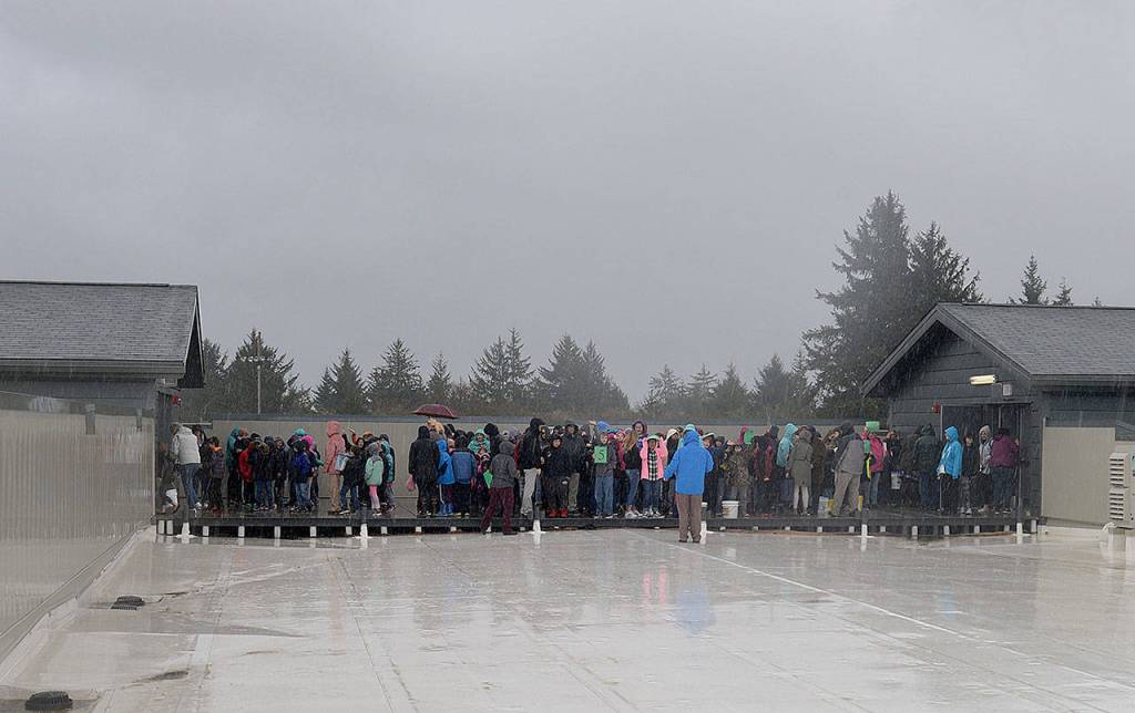
Tsunami drill
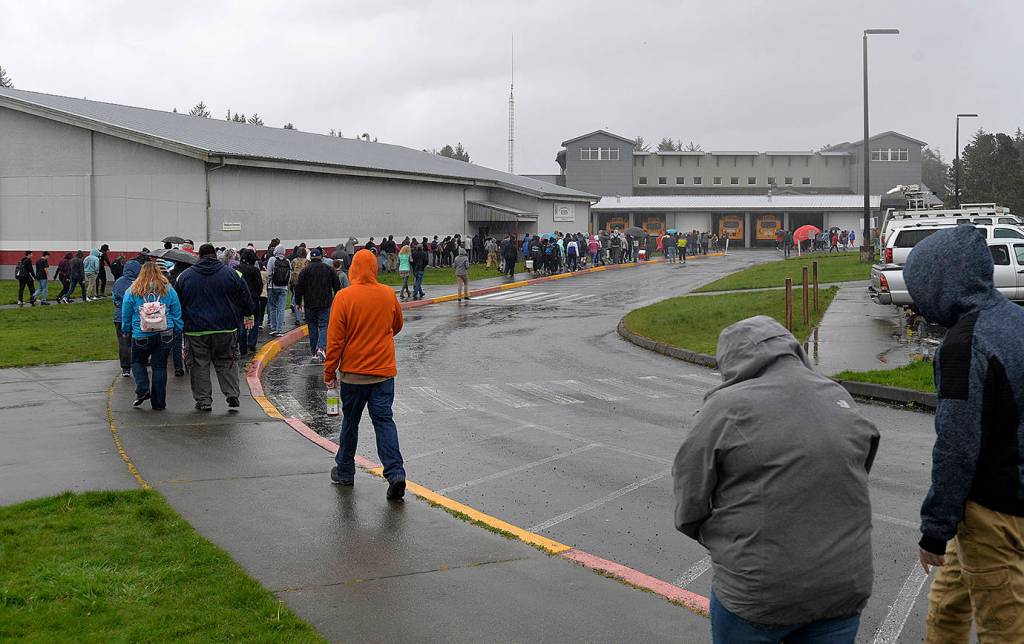
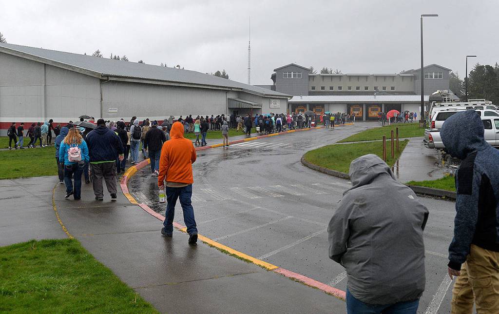
After fielding a few questions, the school’s public address system kicked in with its tsunami warning, directing students and guests to the tsunami evacuation platform at the south end of the school. The flat-topped roof structure was designed to stand up to the worst case scenario. It is stocked with supplies, such as water, food and medical equipment. The platform is accessible by four tower-like staircases and can hold up to a thousand people during an emergency.