Shoreline at full bore: Ocean Shores embarks on effort to save south end
Published 1:30 am Wednesday, November 1, 2023


Editor’s note: This is part one of two in a series about erosion on Ocean Shores’ southern shoreline. Part one outlines the threat to public and private infrastructure and emergency action to protect it; part two, which will publish in Thursday’s newspaper, will describe the driving factors of erosion, the framework for environmental resilience on the Washington Coast, and potential long-term mitigation measures for Ocean Shores.
Two side-by-side aerial photos — one from 1984 and one from 2022 — of the southern shore of the Ocean Shores peninsula give the impression that sometime in the last four decades a mighty sea creature took a massive hemispherical chomp from its bay-side corner, leaving Damon Spit dangling into the harbor as leftovers.
A time lapse of photos from the years in between shows the loss was gradual — waves and currents carved away beaches, dunes and wetlands, deepening the cove at the cap of the peninsula.
Old property maps of Ocean Shores also display a loss of land, empty plats penciled by early Ocean Shores developers covered in water, a body known as Oyhut Bay.
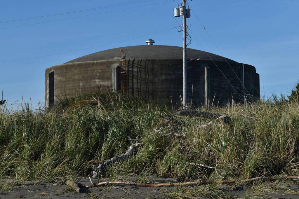
A recent study of the area suggests that without action the pattern will continue in the next few years, only now, homes, roads, canals and a water tank lie in the way, presenting anywhere from $20 million to $28 million of damages to public and private infrastructure.
Technically labeled the Southern Shoreline Erosion Assessment, the recent analysis maps the history of erosion at Oyhut Bay, predicts the further loss of land, and spells out pros and cons of potential solutions for the city of Ocean Shores, which hopes to save its shoreline from washing away in the coming decades and, more urgently, brace it for storm swells in the coming months.
“We’re in high speed, trying to get all the players together,” said Ocean Shores Lead Planner Marshall Read.
Ocean Shores Mayor Jon Martin said he has charged city staff with preparing long-term erosion protections as well as emergency measures should an extreme storm event breach the dunes and threaten Marine View Drive or other infrastructure.
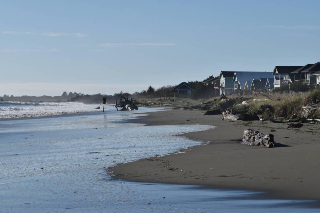
By compiling aerial imagery, water level data, and topographic surveys, civil engineering firm Mott MacDonald revealed Ocean Shores’ southern shoreline has pushed northward a total of 3,000 feet in the last four decades, at an average rate of 60 feet each year. Yearly rates have varied from a fraction of that — 13 feet — to nearly three times the average.
In February the engineers measured a 200-foot distance from the shoreline to Marine View Drive. Without mitigation, the engineering firm predicts, waves will close that gap in four to five years, overtaking the right-of-way. With higher erosion rates, the road could begin to crumble in one to two years.
If that were to occur, the study predicts it could take another one or two years for the ocean to breach the bottom end of the city’s 23-mile system of freshwater lakes and canals, at the same time taking out water pipes that feed into the city’s looped system, and impacting a one-million gallon water tank. In addition, 50 private homes lie within estimates for future shoreline locations.
With slower erosion rates, the study suggests this all would take up to two decades. City officials would rather not wait around to find out.
Read and other city staff are currently working with an engineering consultant to develop immediate protections from erosion, although it’s unclear as of late October what that will look like. They began discussions by examining recommendations outlined in the recent study, including cobble berms or some form of buried hard structure. The assessment identified a potential project area on the beach from the Damon Point parking lot to roughly a half-mile west of there, which would shield homes as well as the public infrastructure behind them.
Most of that area is private land, meaning the city will need to work with landowners to complete the project.
The city will run design ideas by state shoreline stabilization experts, a process that will take at least a couple of weeks before designs will go before the city council for approval.
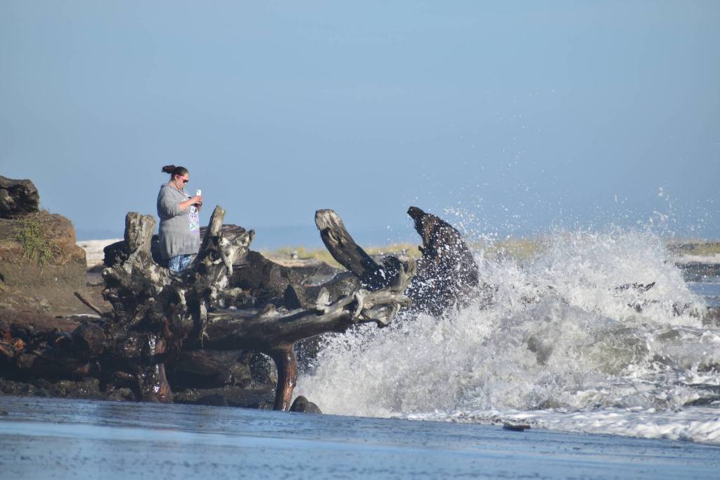
Read said he hopes construction could begin by the end of November or December. He said the most immediate threat to property is an extreme weather event, likely the result of a corresponding king tide — an abnormally high tide — and a southwest-moving storm. Ten-foot king tides are scheduled for late November, as well as in December and January.
“It may not happen in one storm,” Read said. “We may have an opportunity to react.”
In the past several weeks, the planning department granted a handful of passes on shoreline permitting requirements to landowners who wanted to build makeshift erosion structures to shield their properties. Allowing the structures is “not an exemption from permitting, it’s an emergency response that allows deferred permitting” to a later time, Read said.
“I can tell you that in the state of Washington letters of exemption have not been processed faster than what we’ve done in the last month out there,” Read said in mid-October.
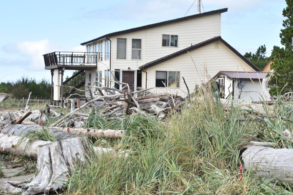
Several residents on Marine View Drive, many of whom are second homeowners, have gathered driftwood logs from the beach, bound them together with steel cables and placed them at the edge of the dunes — or, for one resident, near the edge of their back porch — to brace potential king tides. Read said others have built small retaining walls using two to three-foot rocks.
The city also has two contractors on call that could provide work in the event of an emergency, along with a public works team that could complete a project quickly following a minor breach. The city is setting up a response group of firefighters and police officers to assist with relocation or moving belongings of affected residents.
Read said saltwater is most likely to encroach in two areas: the Damon Point State Park trailhead near the east end of the road, or a few hundred yards to the west at a smaller trail access point. Several times already this year, saltwater has pushed up that trail and into a ditch on the other side of the dunes, which feeds the southern end of the Ocean Shores freshwater canal and lake system.
Saltwater entering through that culvert is a mild concern for city officials compared to a full breach of the fresh waterways, which would subject a canal and nearby lake to saltwater intrusion and tidal fluctuations, killing fish, plants and threatening hundreds of private properties on the water.
In that case, Read said, the city would likely construct some kind of earthen dam at the north end of Lake Minard to prevent the entire system from draining.
The city will need to supplement plans and designs for an emergency erosion buffer with an avenue to pay for it. Martin said the city has reserve funds for emergency situations such as this, but also said the costs for a short term measure is more than the city could afford with current budgeting.
“We’re going to need to work with multiple agencies to come up with solutions,” Martin told the city council earlier this month after a briefing on the results of the erosion assessment.
After the briefing, Councilor Kathryn Sprigg called the information “alarming,” and encouraged devoting resources to the project, as well as the possibility of Mayor Martin declaring a state of emergency for the city.
“It seems to me that if we need to reconsider our budget priorities, this ought to be at the top of the list,” Sprigg said. “If we need to postpone other projects, this ought to be the one that we’re doing.”
“This is imminent,” she continued. “They’re saying 60 feet a year. I go by that every day — there’s not 120 feet on the waterfront.”
Contact reporter Clayton Franke at 406-552-3917 or clayton.franke@thedailyworld.com.