Rocking and roiling
Published 4:00 pm Friday, January 18, 2019


Using tracking devices to follow the movement of rocks may seem odd, but that’s what’s being done to help the state Department of Ecology and local residents track the effectiveness of anti-erosion measures on the shoreline at North Cove — aka Washaway Beach.
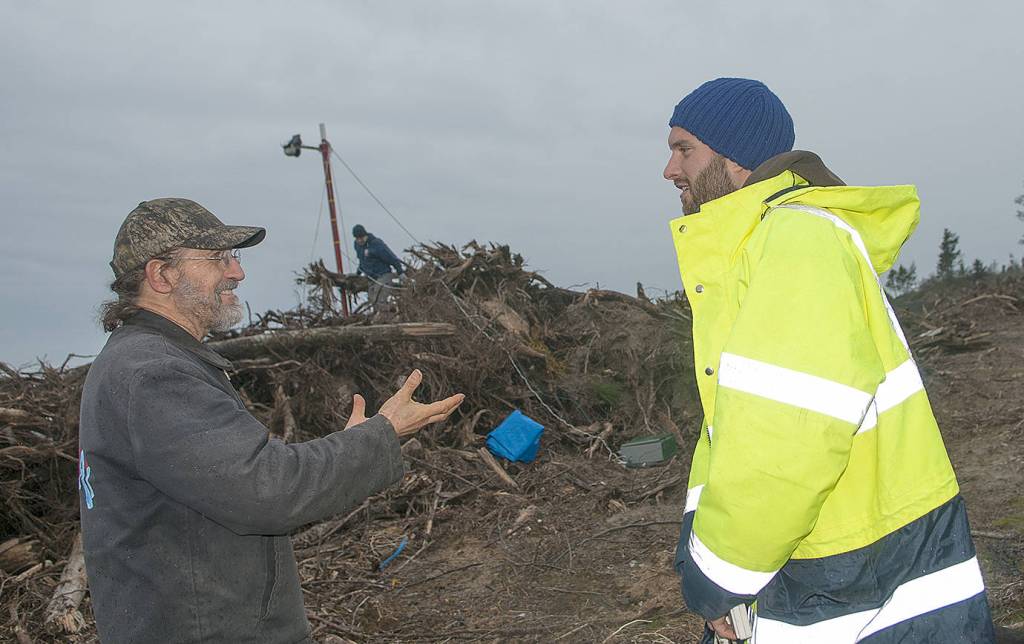
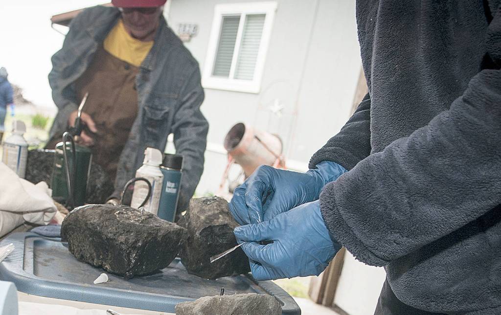
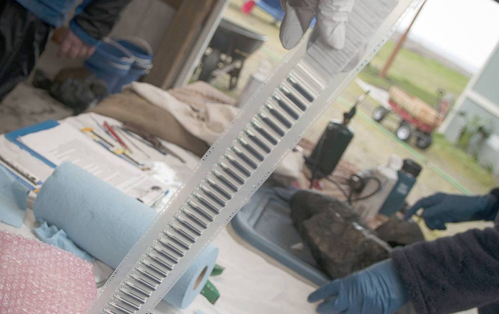
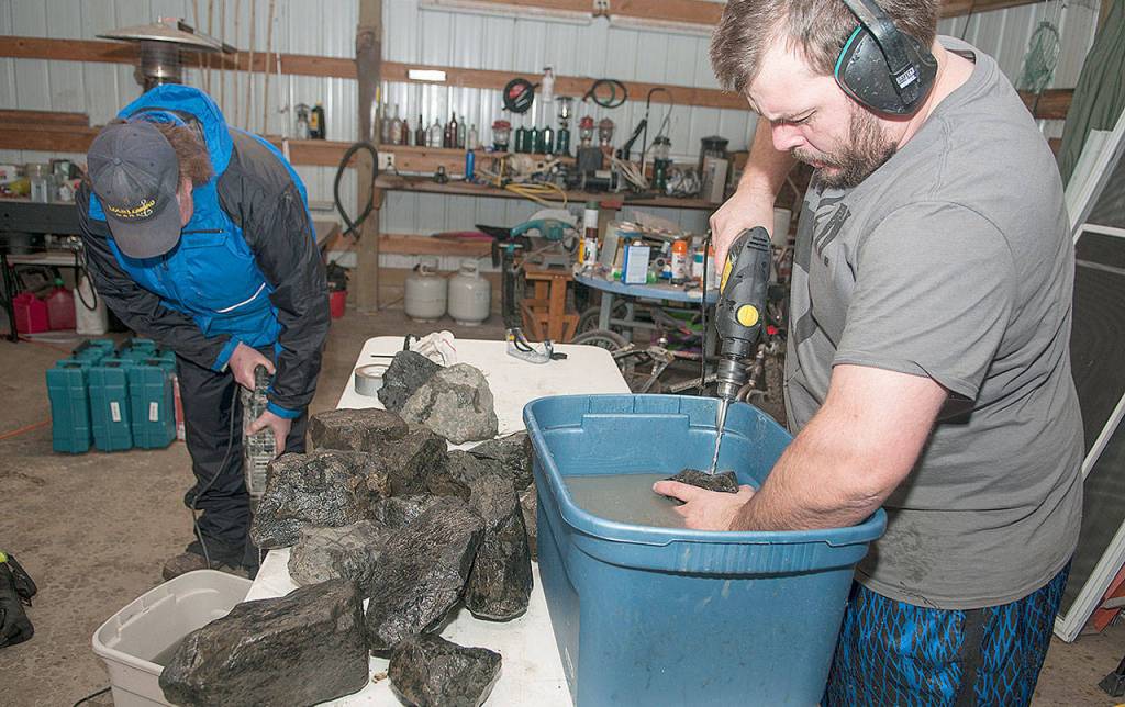
North Cove community members teamed Wednesday with the Department of Ecology to drill holes in about 140 rocks and fit them with passive-integrated transponders, also known as PIT tags. These will be placed among the rock cobble that makes up what is known as the dynamic revetment — strategically placed cobble stones designed to disperse wave energy and limit shoreline erosion. The stones will be monitored to follow their movement along the coastline.
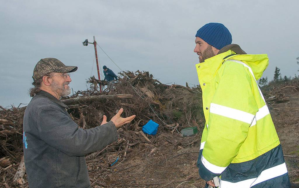
“It was great to see the high level of enthusiasm and participation of the local community,” said George Kaminsky, Department of Ecology coastal engineer, who has been monitoring the rapid erosion of the North Cove shoreline for 25 years. “Their support of this research is incredible, and it is wonderful to experience the positive spirit of the North Cove community.”
Local resident Connie Allen, one of the driving forces behind North Cove’s “Wash Away No More” movement to control shoreline erosion, described the day’s activities.
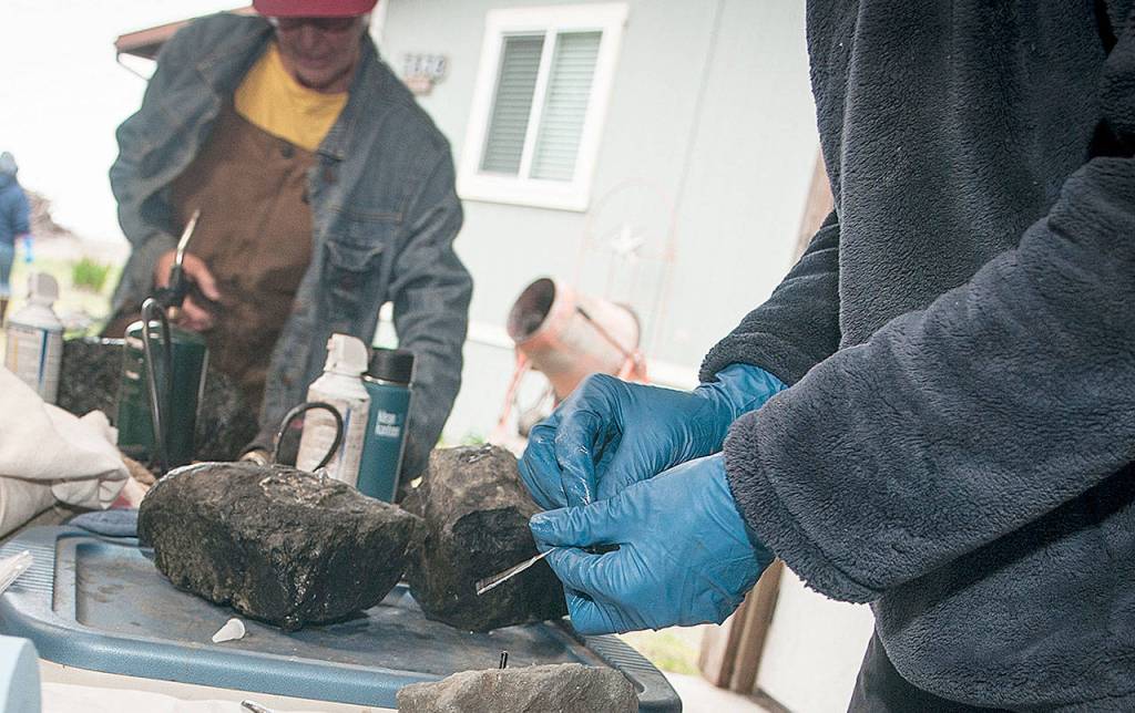
“Richard Harris, who hosted the rock-drilling event, gathered and washed local basalt weighing 3 to 40 pounds. We sorted the stock into three sizes and drilled the appropriate size hole. After cleaning and drying the hole, Diana McCandless secured the tracking device with silicone.”
Harris had property in the North Cove area that was washed away. McCandless is an environmental specialist with the Department of Ecology. Tokeland jewelry maker Judith Altruda, Pacific County Drainage District #1 commissioner David Cottrell, North Cove resident Bob Merrill, Grayland glass artist Jeremy Bartheld, and local resident Brad Kirkland were among several others participating.
Ecology measured, weighed, photographed and recorded the identification number of each of the rocks Thursday. The rocks were placed Friday “along the dynamic revetment at specific profile locations and elevations,” their placement carefully logged, said Kaminsky.
The tracking devices are small tubes that “work like the chip on a credit card,” said Allen.
“Each tag has a unique identification number that is detected with an antenna connected to a reader unit,” said Kaminsky. The antenna is an oval-shaped wire ring attached to handle and is used similar to a metal detector to locate tagged rocks. “Over time we will use the antenna and reader to detect the tagged cobbles and examine the distance and direction they are moved by waves and currents. We will learn how they may get sorted by size, and also how the size and shape of the cobbles change over time due to collision and abrasion with other rocks. This will help us determine the durability of the material, and how to optimize the overall performance at minimum cost.”
Kaminsky said there will be short-term monitoring this month and more surveys in February and March.
“Monitoring the change in size of the cobbles is more labor intensive and will be done less frequently, depending on how quickly they appear to be getting smaller, and the extent to which funding allows,” said Kaminsky.
International interest
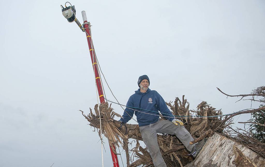
Also on hand Wednesday was Paul Bayle, a coastline researcher from the University of Bath in southern England. He is researching dynamic revetment using lidar technology, which works similarly to radar but instead makes measurements useing laser lights.
“Little North Cove is of interest to English coastline research,” said Allen.
“The cobble tagging and tracking is a complementary method to the lidar profiling,” said Kaminsky. “The lidar system measures changes in the elevation of the beach and dynamic revetment across the profile.” The profile is a line perpendicular to the shore that runs across the crest of the dynamic revetment and down the shoreline toward the sea.
The cobble tracking will be compared to the changes in the beach and dynamic revetment slope measured by both the lidar and the Department of Ecology’s topographic surveys.
“It will help us understand how waves and tides are interacting with the cobble material on the upper beach and sand on the mid beach,” said Kaminsky.
Needed research
While the dynamic revetment so far appears to have proven effective along North Cove, Kaminsky said very little research has been done to understand exactly how it works.
“The dynamic revetment that backs a sand beach mimics the functions of a natural composite beach that has gravel and cobble generally above mean higher high water and sand below that elevation,” he said. “While these kinds of beaches exist in many places around the world, relatively little research has been done to understand how these two types of materials across the beach profile work together to reduce the erosive power of storms, and under more moderate conditions, how the gravel and cobble material absorbs the run-up of waves to build up the sand levels along the upper beach.”
Shorelines, king tides and sandwiches
Washington Sea Grant and The Nature Conservancy will give short presentations about king tides, sea level rise, and local coastal projects during lunch at the Local Bar and Grill in Grayland Monday, Jan. 21 starting at 11 a.m. Lunch is available but not provided and the venue is open only to those 21 and older.
After the presentations the group will travel to the end of Old State Route 105, in the middle of the revetment project, to see how the shoreline stabilization effort stands up to king tides; there is a king tide at 12:30 p.m. that day of nearly 11 feet. The Local Bar and Grill is located at 2183 State Route 105 in Grayland.