
The Chehalis Basin Strategy has unveiled a new interactive map that provides an up-close look of the flood control projects from the comfort of your own home.
The map is available online at storymaps.arcgis.com/stories/2d8553a1e54440ce89ccf59d0c1ae204. It includes a map of the entire basin, a timeline of flood events dating back to 1971, and the interactive map, where you can click on specific projects to find out more details about each and see photos of the work that is being done.
Local projects include several on the Satsop River and numerous projects in Aberdeen and Hoquiam.
Two of the three “featured projects” on the page are local: the Montesano wastewater treatment plant on the Wynoochee River and the North Shore Levee and North Shore Levee-West Segment projects in Aberdeen and Hoquiam.
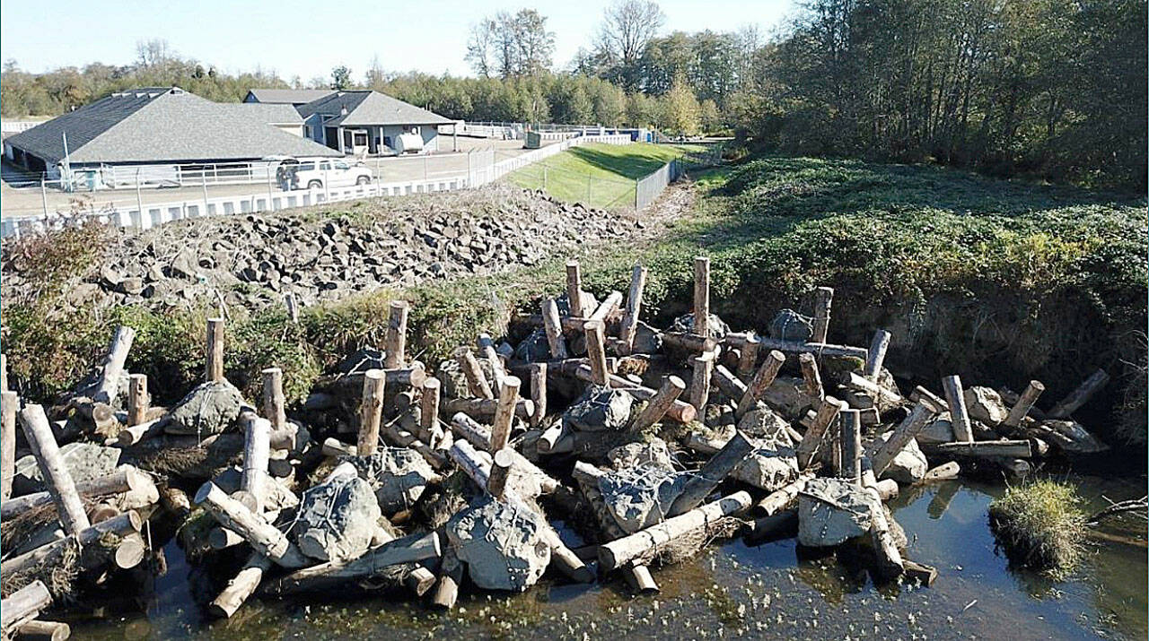
The Montesano wastewater treatment plant sits right on the banks of the Wynoochee and has been losing about 17 feet of river bank every year. If the plant was breached, millions of gallons of untreated wastewater could potentially be released into the river, which feeds into the Chehalis River and ultimately Grays Harbor.
The city of Montesano has been working on a multi-phased plan to protect the plant, starting in 2018 when a series of log jacks were constructed on the bank above the water line — as the bank continued to erode, the log jacks fell into the river, reducing erosion while a permanent solution was developed.
The second phase in 2019 involved log jacks again, this time placed in the river next to the plant’s sheet pile wall. According to the Chehalis Basin Strategy, the log jacks are doing the job and have already created a change to the flow path of the river.
The Chehalis Basin Strategy has contributed about $18 million to Aberdeen and Hoquiam flood control efforts as the cities work on final design and try to secure funding for the $78 million levees project that will take thousands of properties off the mandatory flood insurance map. Both projects are in good shape to be shovel-ready in 2023.
There are currently 38 flood control projects on the interactive map. The map also includes access to aquatics restoration projects, and has tabs to select projects that are active, cancelled, completed, or proposed. Altogether, more than 100 projects can be accessed on the map.
