Hoquiam levee would remove 1,000 homes, 2,000 parcels from mandatory flood insurance requirement
Published 4:30 pm Monday, January 6, 2020


If all goes to plan and funding can be secured, a flood wall protecting downtown Hoquiam could break ground as early as 2021.
“It’s definitely a target to be under construction in 2021,” said Hoquiam City Administrator Brian Shay. “We are motivated to get it out to bid as quick as we can do it for our citizens. As soon as we can do this the better.”
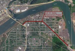
The North Shore Levee West Segment, as it’s called, would protect more than 1,000 homes and more than 2,000 parcels of land from flooding and get those properties off the federally-required flood insurance map.
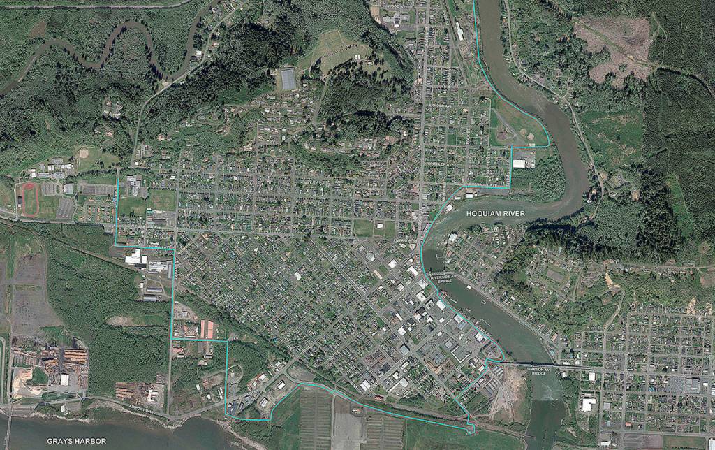
This levee is separate from the larger North Shore Levee project, which would run from east Aberdeen along the Chehalis River to the mouth of the Hoquiam River. The North Shore Levee would protect the homes and businesses in Hoquiam east of the Hoquiam River, but the design leaves out downtown Hoquiam, Hoquiam schools and residences west of the river.
The West Segment would cover much of the remainder of Hoquiam, including downtown businesses, the elementary and middle schools, and private residences west of the Hoquiam River.
KPFF Consulting Engineers in Lacey, the same firm doing the work on the North Shore Levee, has completed its conceptual design, working closely with the City of Hoquiam to come up with a preferred design to be submitted to FEMA for approval.
“The Chehalis Basin Flood Authority provided the funding to get the project to conceptual design to be submitted to FEMA for a conditional letter of map revision,” said KPFF Associate Steve Schmitz. “It’s basically a road map for the project moving forward, saying ‘if you build this structure to this height’ (and other specifications) it is approved, accredited and removed from the special flood area.”
The project so far has cost about $650,000, the bulk of that from the flood authority.
Schmitz and Shay said the proposal will be sent to FEMA this month. Approval on the North Shore Levee design took about three months, said Schmitz, the project timeline allows for six months for a decision. If the decision is positive, “we go into actual design,” said Schmitz. “The money hasn’t been allocated for that, but when it is allocated we’d move directly into design and go out to bid” for construction.
“I believe we could get additional Chehalis Basin funds,” said Shay. “There is a call for projects in April and I can see them applying for funding for final design or maybe do some of the pump station work that has to be done as part of the certification process.”
The design of the levee, in order to remove the properties from the flood insurance requirement, has to show that the stormwater system can handle a 25-year flood event, said Shay, which would likely force some specific upgrades to the system.
“We actually put in a new pump station on Ramer Street, and we did that specifically knowing we wanted to get the West Side levee done at some point,” said Shay. “And we’ll likely have to do more of that.”
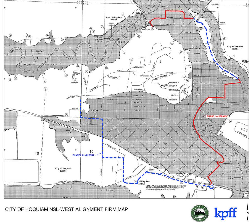
The levee design to be presented to FEMA is split into two parts, Phase 1 and Phase 2. Phase 1 is where construction of some sort of flood protection wall will be required to remove properties from the flood insurance requirement. Phase 2 takes advantage of existing high ground, where it’s possible no construction will be required at all.
“The goal is using the high ground to build as little as possible to remove properties from the flood area,” said Schmitz.
Schmitz estimates the cost of construction of Phase 1 to be in the $20-30 million range. The full buildout of both phases could run to $40 million, if it is determined additional construction is needed.
If the levee is certified, the flood insurance requirement for those 1,000 homes and 2,000 properties would go away, probably about six months after completion, said Shay.
The City of Hoquiam has $1 million in its current budget that could be used for stormwater improvements and other levee-related improvements, including buying rights-of-way, where needed. Shay said the design of the levee incorporates as much city-owned property as possible, lessening the need to secure rights-of-way, which can slow the construction of the levee.
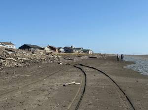
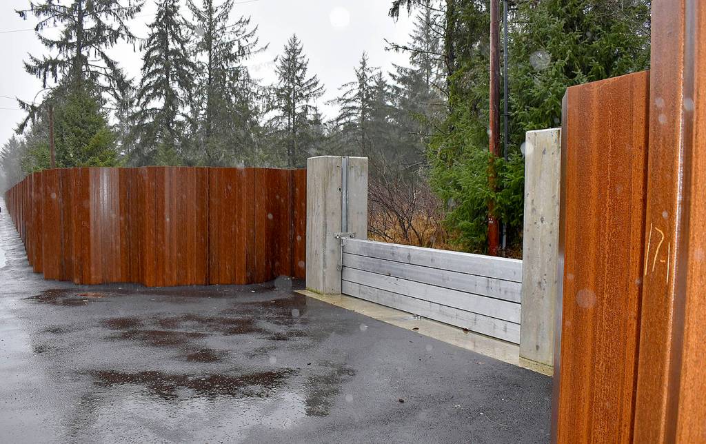
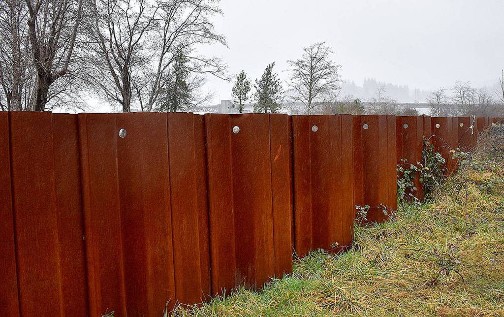
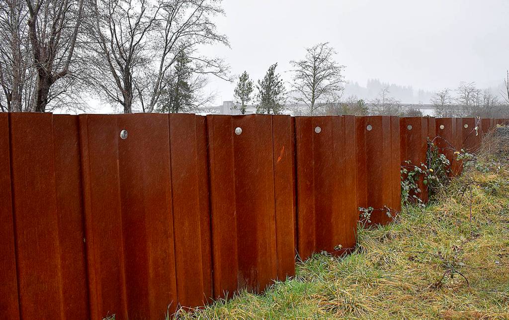
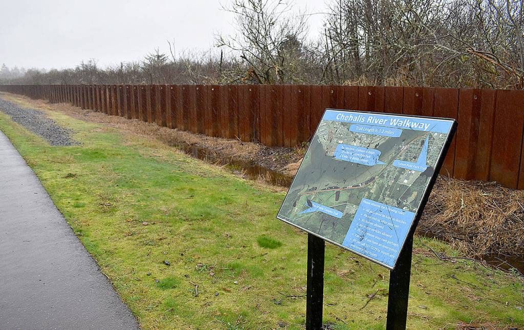
Where a wall would need to be built, the majority of it would be sheet pile, stainless steel sheets hammered deep into the ground. Existing examples in the area can be found a few miles up the Wishkah River just north of Aberdeen’s city limits, and the South Side Levee, on the south side of the Chehalis River west of the bridge.
“At maximum it would be five feet tall,” said Shay. “Generally closer to three feet everywhere there is a sheet pile wall.”
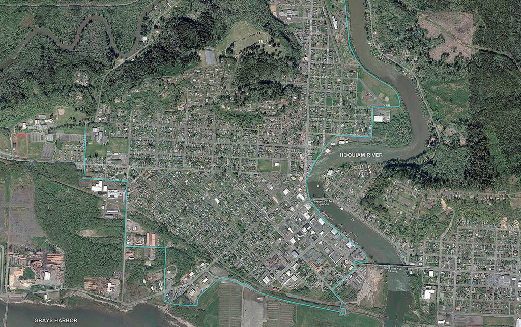
The levee would run basically from Kuhn and Queen avenues in the north east to the west bank of the Hoquiam River. That section is part of Phase 1, where construction will be needed. As the levee winds south along the bank it uses existing high ground, out of the flood plain, to Washington Avenue.
From there existing city rights-of-way would be followed including Washington Avenue, Tyler Street, Chenault Avenue and Polk Street, continuing south past the bridges then cutting east along Levee Street, around the police department then south and west along 11th Street to the railroad tracks. This is also part of Phase 1, where some sort of wall would be constructed.
Existing high ground will be used again as the levee design moves west to South Adams Street, then north to near Emerson, west to Spencer Street, then north to just south of Chenault.
Where sheet pile levee walls intersect streets and driveways, a variety of openings will be incorporated that can be closed if a flood is imminent. These can include fully automated lightweight panels that are bolted into the ground, or can be more primitive gates, said Schmitz. Examples of these are evident along the sheet pile wall along the Wishkah north of Aberdeen. A sheet pile wall, with proper maintenance, has a lifespan of 50-plus years, said Schmitz.
The economic benefits of the levee would be significant for property owners.
“A woman came up to me after a council meeting and had a quote for flood insurance that was like $12,000,” said Schmitz. “Really the economic driver of the project is to remove the special flood hazard.”
Many homeowners under the mandatory flood insurance requirement don’t make efforts to remodel or make improvements to their homes because the cost is so high. Shay said flood insurance requirements can add tens of thousands of dollars to a basic remodel.