
An atmospheric river — a long, narrow column of water vapor — is heading for the region, bringing with it heavy rainfall and the potential for localized and river flooding and landslides.
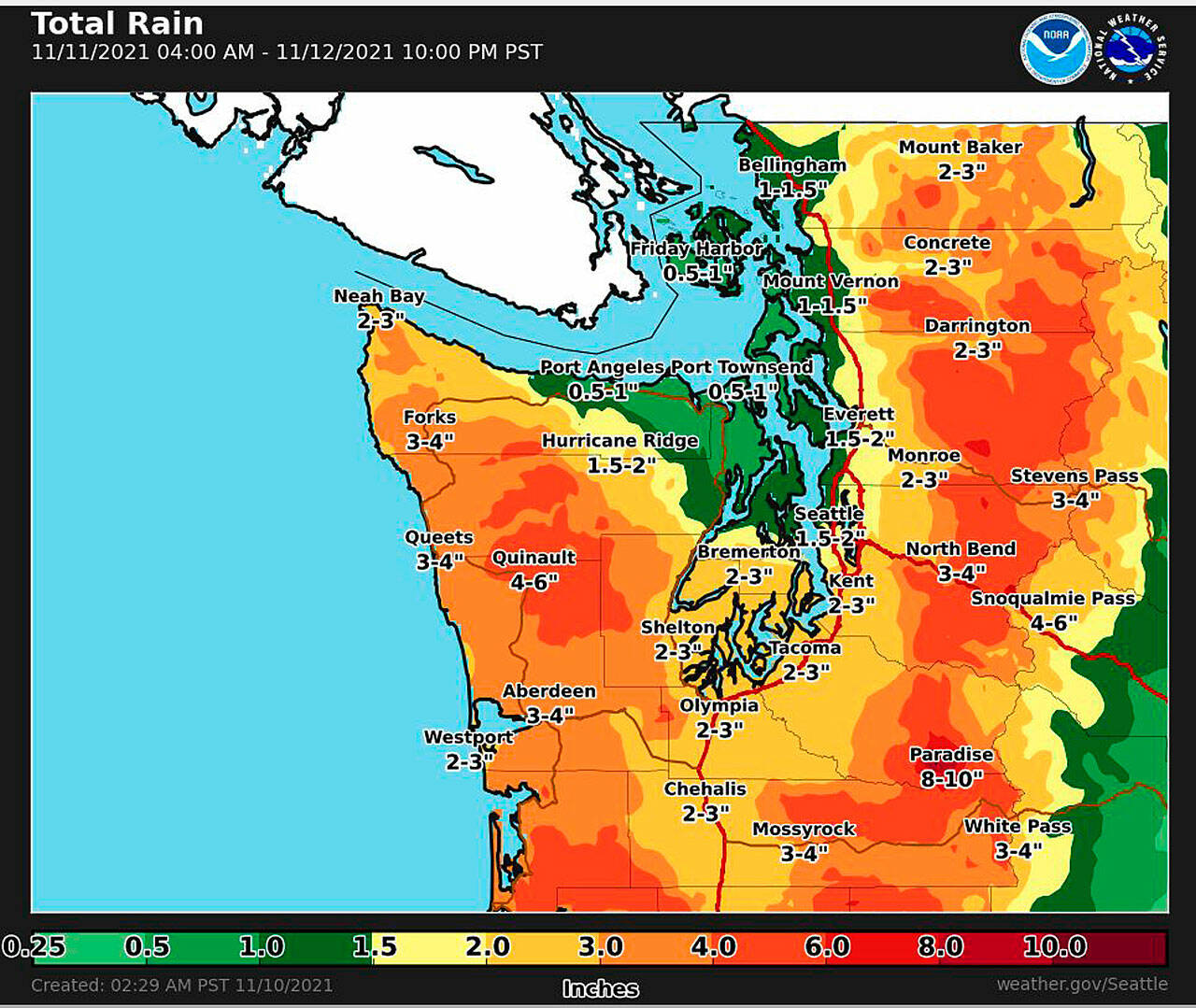
After a brief break from heavy rain late Tuesday and Wednesday, the atmospheric river is expected to make landfall Thursday and bring with it 3-4 inches of rain Thursday and Friday in Aberdeen and Hoquiam, as well as areas of the east county, according to the National Weather Service in Seattle. Rain will actually be a little lighter, if you can call it that, on the coast, with 2-3 inches expected in Westport.
Higher elevations around the Olympics will get even more more rain during that time period, 4-6 inches could fall in Quinault.
There could be flooding along some of the local rivers, likely in the usual spots up the Wishkah and Satsop rivers. Drivers should take care during this time frame as localized flooding in Aberdeen and Hoquiam is possible, as is flooding State Route 105. River flood forecasts can be found at water.weather.gov/ahps2/forecasts.php?wfo=SEW.
Already-saturated ground could lead to landslides, according to the forecast. Updated state Department of Transportation travel alerts can be accessed at wsdot.com/travel/real-time/alerts.
