
UPDATE: The National Weather Service has posted a wind advisory for the north and central coasts for Thursday, with 20-35 mph wind and gusts of up to 50 mph predicted. The advisory is supposed to be in effect until 4 p.m.
The National Weather Service in Seattle has posted a flood watch active from Friday evening through Saturday evening in Grays Harbor County. Total storm precipitation will be up to five inches in the Olympics and southern Cascades, mostly rain below 6,500 feet during Thursday but the snow level will drop to 3,500 feet Thursday night.
The Weather Service’s “special weather statement” for the area said the heavy rains and warming temperatures increase the chance for landslides. Several have been reported already, including one in Mason County near Hoodsport that has all of 101 shut down as of mid Thursday morning.
Just before noon Thursday, the National Weather Service posted a wind advisory for the north and central coast. Winds southwest 20-35 mph with gusts to 50 mph were expected in Hoquiam and Forks until about 4 p.m. Thursday.
Thursday’s forecast calls for up to a half-inch of rain. Showers are likely Friday, with winds 8-14 mph. The chance of rain falls throughout the weekend, with light winds and lows in the upper 30s. Mostly clouded skies are predicted for Saturday night, and Sunday should bring mostly sunny skies with a high around 48.
The Chehalis River is forecast to reach flood stage at Porter near 4 p.m. Friday, crest at 10 p.m. Saturday, then quickly recede by 10 p.m. Sunday. Flooding could affect low lying pasture land and roads. No other rivers are expected to flood, said Charles T. Wallace, Deputy Director at Grays Harbor County Emergency Management.
Along with heavy rains and very low barometric pressure, the tides ahead of Friday’s full moon will be the highest in February. The low pressure will cause tidal anomalies, according to the National Weather Service in Seattle, pushing the tides a foot to a foot and a half higher than their predicted levels. This could cause minor flooding in Aberdeen and Hoquiam due to tidal overflow as rising tidewater backs up into existing stormwater drainage systems. Low-lying areas near the water could also see some minor flooding.
Remember, the tides may be a foot to a foot and a half higher than the following predictions. Thursday’s high tide was predicted to hit 10.4 feet at 11:41 a.m. Friday morning at 1:01 a.m., around the time rains are forecast to begin to diminish, there will be an 8.8-foot high tide, followed by another 10.4-foot tide at 12:33 p.m. Saturday, when the Chehalis is expected to be at or near flood level, there will be a high tide of 9.1 feet at 1:44 a.m. and another 10.2-footer at 1:21 p.m.
The National Weather Service in Seattle issued a coastal flood advisory active through 1 p.m. Thursday afternoon. High tides combined with heavy rains could produce minor flooding along the shorelines around the high tide shortly before noon. The north and central coast are included in the advisory, including Aberdeen and LaPush.
The Raymond area and much of Pacific County is under a coastal flood advisory from 9 a.m. to 2 p.m. Thursday. River flows combined with high tides could cause flooding in low lying areas near bays and sloughs along Highway 101 and the lower reaches of coastal rivers, particularly in the several hours around high tide events.
The National Weather Service in Portland says Highway 101 along Willapa Bay is often affected by this type of weather event. The area surrounding Willapa Bay is also under a high wind warning; winds will gust to 33 mph Thursday night with steady winds 15 to 21 mph are predicted Friday before calming down Friday night.
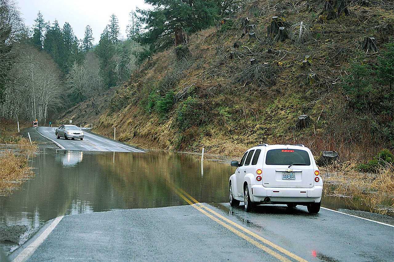
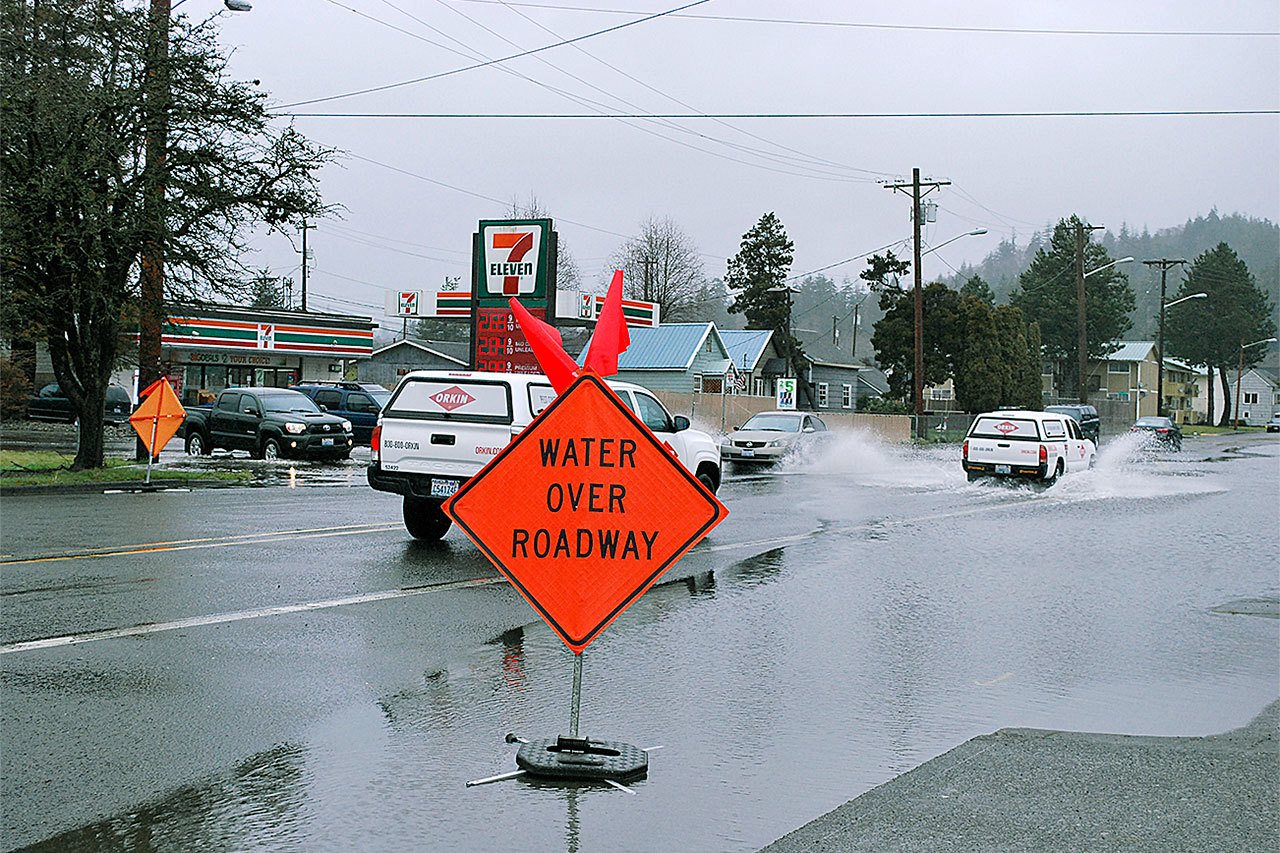
Water over the Blue Slough Road just outside of Cosmopolis Thursday afternoon had the drivers of these vehicles wondering who would be brave enough to try and cross it first. (BOB KIRKPATRICK|THE DAILY WORLD)
