Highway 101— a scenic byway to angling adventure
Published 1:30 am Saturday, July 4, 2026
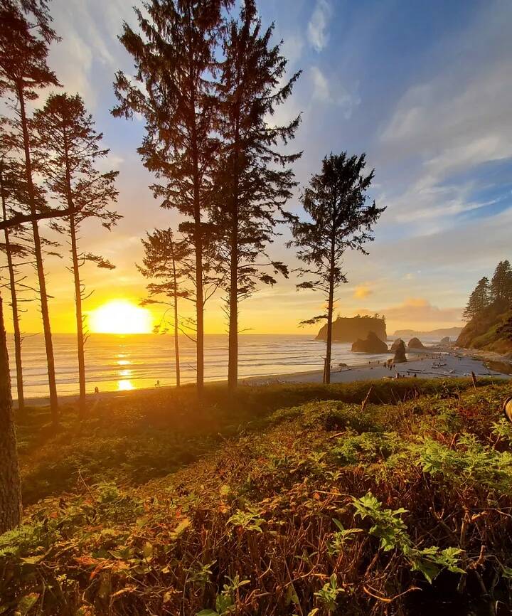
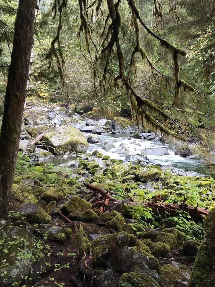
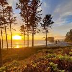
As it orbits the Olympic Peninsula counterclockwise and then slingshots south, the famed West Coast route “Highway 101” accesses many fisheries and other enjoyable outdoor activities.
Planning summer and early fall trips? You’re in luck. The state’s highways and byways crisscross and zigzagging across Washington have many hidden fishing gems along every turn of the road.
We’re taking a look at fishing trips and roadside stops along Highway 101, which encompasses the towering snow-capped peaks of the Olympic Peninsula and makes its way south along the rugged coastline to the Astoria-Megler Bridge on the Washington-Oregon border.
This journey spans about 366 miles passing counterclockwise through the towns of Tumwater, Olympia, Shelton, Hoodsport, Quilcene, Sequim, Port Angeles, Forks, Hoquiam, Aberdeen, Raymond, South Bend, Ilwaco, and Chinook.
You might just find that your next road trip is packed full of fishing choices to suit the needs of just about every angler. While fishing is high on the travel memo, we’re also adding some exciting non-fishing stops along the way too.
HOOD CANAL
Fishing dates: Hood Canal (Marine Area 12) opens south of Ayock Point for hatchery Chinook and all coho beginning July 1; and opens north of Ayock Point for coho beginning Aug. 1. Refer to Washington Department of Fish and Wildlife (WDFW) 2026–2027 regulation pamphlet or the WDFW website for additional Hood Canal salmon opportunities in late summer and fall.
Fish species: Chinook and coho (salmon retention depends on fishing season dates).
Where to fish: Chinook typically migrate into Hood Canal by mid-July and peaks in August. Coho arrive in August and September. Early mornings or just prior to sunset are the best periods to fish. Try for Chinook in Lower Hood Canal off Ayock Point, Hoodsport, Eagle Creek, Lilliwaup, Potlatch, Annas Bay, and Long Point. When open for coho head to Dabob Bay, Quilcene Bay, Scenic Beach, Misery Point near Seabeck, and Hazel Point.
CUSHMAN LAKE
Fishing dates: Open year-round.
Fish species: Kokanee and cutthroat trout.
Where to fish: Lake Cushman in Mason County is located five miles west of Hoodsport. No rainbow trout are stocked but offers kokanee fishing from April through October. Anglers will slowly troll using downriggers with small dodgers and blades trailed with a short leader to a spinner, wedding ring, micro shrimp and plastic squid (hoochie) or a spin-n-glo. Add a single white corn kernel or maggot to the hook with fish scent attractant. A fish-finder is essential to locating schools of kokanee hovering at certain depths.
There’s good late-season cutthroat fishing using flies or a small spinner or spoon. The lake has ample shoreline access along the west side but is best fished in a boat. Cushman Lake State Park located on the south end and Skokomish Park on north side have boat launches and numerous campsites.
STRAIT OF JUAN DE FUCA
Fishing dates: Marine Area 5 (Sekiu and Pillar Point) is open (except the Kydaka Point Area) for salmon during odd-numbered days only from July 1–31 (closed to all salmon fishing on even numbered days) and could close sooner if the harvest quota is met.
Marine Area 6 (East Strait of Juan de Fuca west of a true north/south line through the #2 Buoy immediately east of Ediz Hook) opens for hatchery Chinook beginning July 1 and could close sooner if the harvest quota is met.
Refer to the 2026–2027 regulation pamphlet or the WDFW website for additional Marine Areas 5 and 6 salmon opportunities in late summer and fall and any potential emergency closures.
Fish species: Chinook and coho (salmon retention depends on fishing season dates). There are also select bottomfishing opportunities and refer to the 2026–2027 regulation pamphlet or the WDFW website for details.
Where to fish: In Marine Area 5 try for salmon at the “Caves,” located a couple hundred yards around the corner from the marina breakwater. Other locations to fish are Slip Point, Mussolini Rock, the Coal Mine and Slide Area, and Cod Fish Bay and Pillar Point. There are a number of resorts that provide amenities, charter services, moorage, fuel and accommodations with an awesome view of the Strait of Juan de Fuca.
In Marine Area 6, start your troll or drift west of the Ediz Hook №2 Buoy, then head along the massive sand spit/breakwater jetty to just past the old Port Angeles Pulp Mill. Other options are Winter Hole, an exposed area out in the Strait of Juan de Fuca, where many will drop jigs; and near Port Angeles at the “Humps,” an underwater shelf starting at Buoy 4 — head in a northwesterly pattern to the second and third humps.
WASHINGTON COAST
Fishing dates: Open daily for salmon through Sept. 30 at Ilwaco (Marine Area 1), Westport-Ocean Shores (Marine Area 2), La Push (Marine Area 3), and Neah Bay (Marine Area 4). Each port could close earlier if the guideline or quota is met. The recreational coast-wide Chinook catch quota of 54,000 is up slightly from 53,750 in 2025, and a hatchery-marked coho quota of 102,900 is up from 99,720 in 2025.
Fish species: Chinook and coho. There are also select bottomfishing opportunities and refer to the 2026–2027 regulation pamphlet or the WDFW website for details.
Where to fish: Ilwaco offers some nearby options off the surf line from Cape Disappointment to Long Beach at depths of 25- to 50-feet where salmon stage before migrating into the Columbia River. The ocean fishing grounds are located about seven to 10 miles west of CR Buoy at depths of 50- to 125-feet. Ilwaco charter boats and larger private boats will venture even further along the 200- to 300-foot depth line.
At Westport cross the bar and head north from Ocean Shores to Copalis at depths of 30 to 80 feet but watch your lines closely as you troll since there’s usually a maze of commercial crab pots. The key for near shore fishing is locating schools of baitfish. Anglers can also head in a southwesterly direction out into the ocean by following the buoy line from 100- to 250-feet and as far out as 20 to 25 miles offshore. Others will push even further south off the mouth of Willapa Bay at depths of 150- to 180-feet but keep in mind it’s a long haul from Westport.
At La Push, one of the better spots is a short boat ride from the marina outside of the mouth of the Quillayute River at James Island, and north along the shoreline from Rialto Beach to the Hole in the Wall. Further away from port is an area known as the Rock Pile.
Neah Bay is one of the most “salmon fishy” spots off the coast. The green buoy off Waadah Island and from the “Garbage Dump” west to Tatoosh Island offers a relatively protected area for smaller-size boats. Many will motor mooch a herring in the shallow water (25- to 50-feet) near the kelp beds. Just around the northernmost tip of the state is Slant Rock, and further south is Cape Alava which are popular fishing areas.
BUOY 10, COLUMBIA RIVER MOUTH
Fishing dates: Opens Aug. 1, with alternating block periods of non-mark-selective (wild or hatchery) and mark-selective (hatchery only) Chinook and hatchery coho retention, similar to 2025. Check the WDFW regulation pamphlet for specific dates and what salmon species may be retained.
Fish species: Chinook and coho.
Where to fish: Timing, locating baitfish and knowing what part of the tides to fish are the three keys to success. Typically, you can find fish on the opener but mid- to late-August is best for Chinook.
In the early mornings on a flood tide, make your first few passes just outside the Port of Ilwaco Marina along the Wing Walls, a row of rotting wooden pilings known to grab a lot of fishing gear. It is also a place where hungry salmon will stage and grab your bait as well.
The Desdemona Sands area — a flat sandy bar exposed at low tides — is a mid- to late-flood tide show as salmon pass along the drop-offs on both sides of the channel. Be careful when crossing this area because it can be very shallow along the sandy flats.
The buoy line off the town of Astoria where huge ocean-bound freightliners anchor above the Astoria-Megler Bridge is a decent spot on a flood tide change. Below the bridge try outside of the Astoria Marina to Fort Stevens State Park and west toward Hammond in a series of deep-water channels. On the Washington side just above the bridge are three underwater channels that are passageways for migratory salmon. Just downstream from the bridge is the Church Hole off Fort Columbia State Park can be fruitful too.
Gear consists of a weighted diver or drop ball sinker of 8- to 10-ounces with flasher tied to a leader with a green-labeled whole or cut-plug herring or anchovy. Preferred depth to drop you bait is 25 to 30 feet. Any deeper and you’re out of the fishing zone. Check your bait often as it will get worn after being dragged along the sandy bottom or from the very strong tides. An Anchovy plastic bait holder will protect the bait. Spinners attached to a plastic squid or an artificial cut plug herring-type lure are also effective.
Extra fishing stops along the way
Located within Olympic National Park is Lake Crescent, covering more than 5,000 acres and is regulated by the National Park Service. The lake has a unique population of Beardslee rainbow trout, cutthroat trout, and kokanee. Catch and release fishing only is open through Oct. 31, and an artificial lure with a barbless single point hook is allowed with a two-ounce weight restriction. For fishing rules, refer to the Olympic National Park website.
The Olympic coastal rivers and those to the south that feed into Gray Harbor and Willapa Bay — Hoh, Salmon, Quillayute, Bogachiel, Sol Duc, Chehalis, Humptulips, Black, Satsop, Naselle, Smith Creek and Willapa — are options to catch salmon in late summer and fall but much of that will depend on water conditions. WDFW will monitor the low mountain snowpack, which brings the potential for drought conditions; high water temperatures; extended hot weather this summer; and low water levels. These conditions could impact fisheries and salmon migration in late summer and early fall. Anglers should check the 2026–2027 regulation pamphlet for opening dates, and WDFW’s emergency fishing regulations webpage for any in-season changes.
Beginning Aug. 1, head to Willapa Bay (Marine Area 2–1) for a hatchery king fishery, which is something to not overlook this month and has a two adult salmon daily limit (release wild chinook). A forecast of 28,120 chinook should create some good times for anglers inside the bay’s deep channel along the red and green channel markers numbered from 2 to 27 (fish markers 7 to 13 are the popular areas). The markers start in the middle of the bay and run all the way to the Willapa River mouth. Target a flood tide to avoid foiling up your gear on eel grass and seaweed.
Grays Harbor (Marine Area 2–2) east of the Buoy 13 line opens on Sept. 16 and can be decent for coho well into October. Depending on which way the tide is moving start at the Goal Post (a set of rotting wood pilings) near the entrance to the Johns River and troll along the south channel. This a trough that runs east and west toward the Chehalis River mouth. Use Stearns Bluff, a landmark hillside east of the Johns River as the end or start spot. A set up consists of a six- to eight-ounce drop sinker attached to a three-way slip swivel with a flasher to a six-foot leader and cut-plug herring. Let out 12 to 16 pulls of line — at depths of 15 to 25 feet — so your bait is spinning a foot off the sandy bottom. The best time is during the flood tide, but there can be a brief bite on the ebb tide. Unlike other salmon fisheries you don’t have to be out right before daylight, and it’s all about the tides.
Hundreds of other statewide seasonal lowland lakes have been stocked since opening day on April 25, and fishing should remain productive through this month. On the coast, try Duck Lake near Ocean Shores (4,650 catchable trout planted in spring, and 950 jumbos planted in May); Aberdeen Lake (7,050 catchable trout planted in spring, and 1,850 jumbos planted from April to June), and Black Lake in Pacific County near Ilwaco (12,000 catchable trout planted in spring and October, and 500 jumbos planted in April).
Destinations along the way
Other outdoor destinations: Make it a combo outing by spending some time camping, hiking, sightseeing, wildlife watching or simply strolling in the many state and national parks and other local parks. Coastal stops also include beach exploration, seaside camping, and boating.
They include Olympic National Park; Hoh Rain Forest; Cape Disappointment State Park near Ilwaco (Lewis & Clark Interpretive Center and North Head Lighthouse); Grayland Beach State Park; Leadbetter Point State Park, Pacific Beach State Park; Tolmie State Park; Ocean City State Park; Dosewallips State Park; Hope Island State Park; Lilliwaup Tidelands State Park; Triton Cove State Park; and Potlatch State Park near Shelton.
Coastal beaches: Ruby Beach located within Olympic National Park; Rialto Beach’s Hole in the Wall rock formation; La Push’s first, second and third beaches located 12 miles west of Forks; Deadman’s Cove and Waikiki Beach in Cape Disappointment State Park; Kalaloch Beach; Shi Shi Beach, a remote beach on the Makah Reservation; Westport beaches features Half Moon Bay and Westhaven State Park; Moclips to Copalis Beach; and Ocean Shores offers seven-miles of sandy shoreline and easy access. Long Beach is the longest drivable beach in the state and covers 28 miles of the southern coast.
Hood Canal hikes: Visit Hamma Hamma Falls a 75-foot waterfall; Mount Walker Viewpoint, a moderate four-mile hike with a 2,000-foot elevation gain near Quilcene; Rocky Brook Falls a 229-foot waterfall near Brinnon and a five minute drive off Highway 101; and Staircase Rapids Trail, a two-mile, 500-foot elevation gain, located about 30 minutes from Hoodsport.
WDFW-managed lands: More than one million acres of wildlife area lands can be found throughout the state. To find them, refer to the WDFW Wildlife areas webpage. WDFW also manages hundreds of water access sites throughout Washington, providing recreational access to the state’s lakes, rivers, and marine waters. To find water access areas, refer to the WDFW water access areas webpage.
Mark Yuasa is a Washington Department of Fish and Wildlife Communications Manager. He also was the outdoor reporter at The Seattle Times for 28 years.