Earthquake simulations depict a dire future for coastal communities
Published 1:30 am Friday, October 27, 2017


The scenarios for a major earthquake along the coast of the Pacific Northwest are virtually endless, with variables such as epicenter, the length of rupture along a fault and intensity of the tremors, making it difficult to predict where damage will be the worst and how communities should plan.
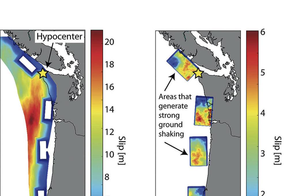
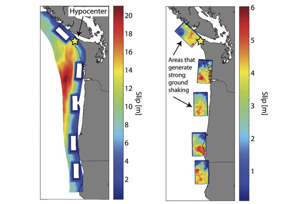
This week in Seattle at the Geological Society of America’s annual meeting, scientists unveiled 50 new simulations for how a magnitude 9.0 earthquake would affect the region. Prior to this, there were only several detailed simulations, so having 50 that test a multitude of factors gives researchers a much more comprehensive look at how catastrophic it could be.
It’s a significant advance from the small pool of data that previously existed, said Erin Wirth, a scientist from the U.S. Geological Survey who presented the simulations after three years of work.
“With just a few simulations, you didn’t know if you were seeing a best-case, a worst-case or an average scenario,” Wirth said in a press release. “This project has really allowed us to be more confident in saying that we’re seeing the full range of possibilities.”
Off the coasts of Washington and Oregon, the Juan de Fuca plate is slipping under the North American plate, building up energy that will shake the region when it inevitably lets loose. The simulations take several important factors into account, such as how far the tremors extend inland from the coast, and the ‘stickiness’ of the plates as they rub and move against each other.
Wirth’s work is part of the University of Washington’s M9 Project, a $3 million, four-year effort dating back to 2014 with 20 professors and students working to predict how and when the earthquake will unfold and what locals should do to prepare. Other members are researching how disastrous a tsunami caused by the earthquake would be, and how buildings would hold up in such a scenario.
One of the biggest challenges for Wirth and her co-workers has been the lengthy nature of the project, as they had to send simulations to super computers at the University of Texas, Austin, and the Pacific Northwest National Laboratory in Richland to calculate the final outcomes.
“The amount of computer power it took was a lot. One simulation would take at least 10 hours, with more than 500 computers on at the same time,” Wirth said to the World.
Now that there are 50 simulations that show how shaking would occur, other groups in the M9 Project are eager to combine their work with Wirth’s to get more insight.
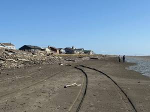
According to Frank Gonzales, a professor in the project who specializes in mapping tsunamis, that aspect of the report is still a few years away from completion, but will be assisted by now having 50 simulations they can use to interpret the effects of numerous specific tsunamis. In his work so far, Gonzales said areas such as Ocean Shores stand out as being particularly threatened by a tsunami, as it’s located on a thin peninsula with the ocean to the west and a harbor to the east, with no real escape option in the case of severe flooding.
“There’s nowhere for them to go,” said Gonzales. “We’ve had a series of projects that model this. Now the focus is, ‘OK, how the hell are we going to get out of here? We better build a big berm, or a tower, or we better reinforce some buildings, because we can’t run inland, we can’t run along the coast, so we’re going to have to go up.’”
And although Wirth’s simulations do show the severity of shaking throughout different hypothetical earthquakes, it doesn’t take into account soil type, which she hopes to now combine with the 50 cases.
“In general, soft soils tend to amplify ground shaking, which shakes harder than a hard rock site,” said Wirth. “In the near future we want to combine the results of our computer simulations with maps of local soil conditions to make maps of shaking intensity that can then be used by the public, that’s something we’re hoping to get out in the next few months.”
One of the noticeable and expected outcomes was that coastal communities experienced more shaking than inland cities that aren’t in the direct path of an offshore earthquake.
“In all our simulations, of course, there’s more shaking along the coast because it’s closer to the fault,” Wirth said. “But even within that there’s a lot of variability that affects how powerful the earthquake would be.”
Scientists say the last time a major earthquake took place on the Cascadia subduction zone was in 1700, and is now approaching the tail end of its 500-year cycle to strike again. The U.S. Geological Survey estimates there being a 10 to 14 percent chance of a magnitude 9 earthquake happening in the next 50 years.