Army Corps proposes placing sand at South Jetty to prevent potential breach
Published 5:30 pm Friday, August 2, 2019

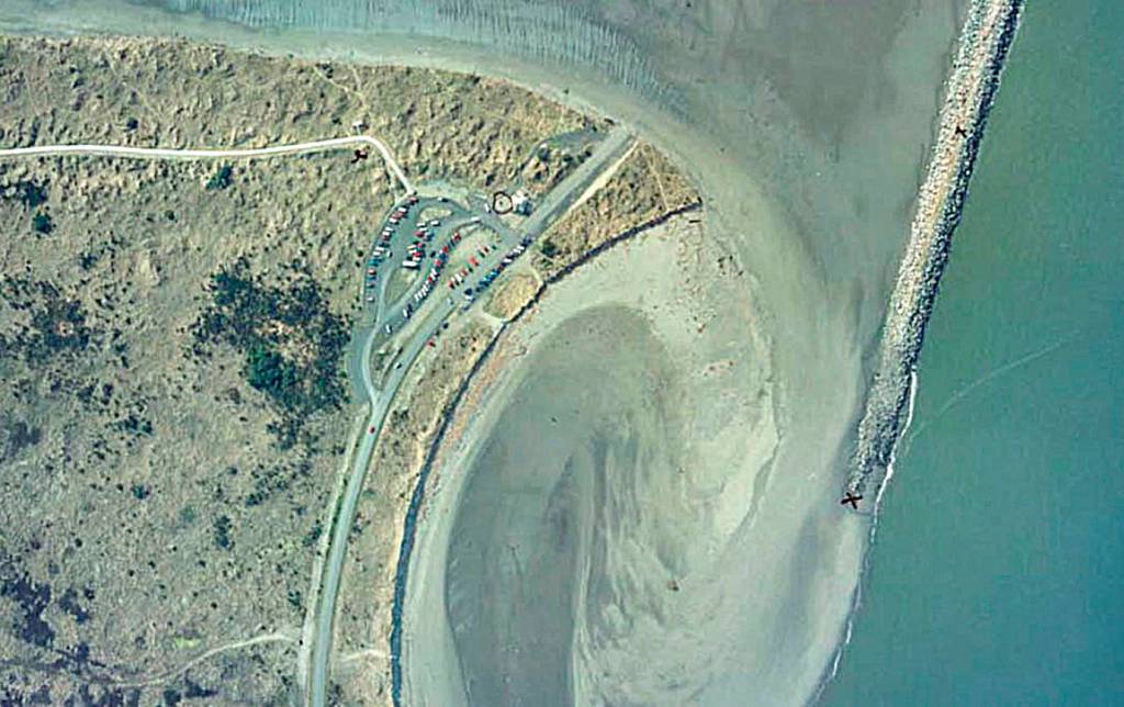

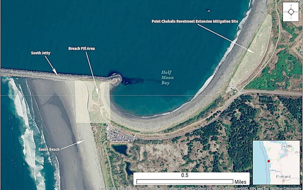


The Army Corps of Engineers is proposing shoring up the sand spit that connects Westport’s South Jetty with the mainland on the west side of Half Moon Bay with up to 90,000 cubic yards of sand to protect the jetty, the city’s infrastructure and the federal navigation channel at the entrance of Grays Harbor.
“A breach at the Half Moon Bay area of the South Jetty has several potential consequences for Westport and State Parks,” said Kevin Goodrich, Westport public works director. “A breach could impact the State Park facility at the Westhaven side of Westport Light State Park including the comfort station, parking facility, beach trail and beach access.”
According to an Army Corps draft supplemental environmental assessment, quarterly surveys since 2005 show the western shoreline of Half Moon Bay has moved inland about 50 feet between August 2014 and January 2018.
“From the city side of things, without the protection of the jetty/sand barrier, a breach could directly impact our water treatment facility and outfall,” said Goodrich. The facility is just east of the east shore of Half Moon Bay at the corner where North Montesano Street turns into Dock Avenue.
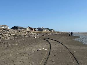
In the event a breach were to occur during a severe storm or a series of storms, there is the potential to wash out or overtop at Half Moon Bay, which could impact most of the Marina District, said Goodrich.
“This would affect infrastructure, the commercial seafood industry, the bulk of our tourism-oriented businesses,” said Goodrich. “In a worst-case scenario there could be damage to the Port of Grays Harbor infrastructure in the marina as well.”
Army Corps surveys show evidence that the fill area known as South Beach has been “overtopped by water from the west from one or more storm events, resulting in avalanching of sediments from the dune into the intertidal region.”
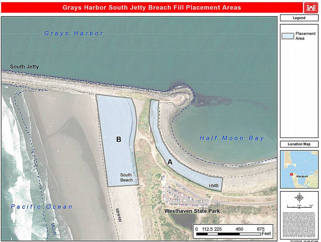
With the loss of 15,000 cubic yards of sand due to erosion on the western curve of Half Moon Bay, the Army Corps proposes placing up to 30,000 cubic yards of sand in the area between the east end of the South Jetty and just east of the Westhaven State Park parking lot.
The Corps will address the issue before the area is breached and the South Jetty is separated from the mainland by placing up to 60,000 cubic yards of sand on the South Beach side of the breach fill area.
“The potential economic impact of a severe breach is difficult to estimate,” said Goodrich.
Sand placement could begin as early as mid-September and continue as needed through 2024, according to the Army Corps. The last time this type of action was taken was in 2012, when 30,000 cubic yards of sand was put in place.
Since then, “the South Beach area has been eroding near the connection between the breach fill area and South Jetty and has formed a concave pocket immediately adjacent to South Jetty,” according to the Army Corps of Engineers report. “There is strong evidence of the beginning of flanking along the South Jetty at this location.”
“In order to restore the recommend level of protection to mitigate the risk of a breach, up to 45,000 cubic yards of sand is required to replenish the breach fill area in Placement Area B on the South Beach side and up to 20,000 cubic yards is required on the western curve of Half Moon Bay in Placement Area B,” reads the Corp’s draft assessment.
Most of the sand used for the project will come from the Point Chehalis Revetment Extension Mitigation Site, on the east side of Half Moon Bay. Additional sand would be sourced from an upland quarry, according to the Corps.
Additional sand placements could occur through 2024 if Corps surveys show they are necessary, while the Corps develops an long-term strategy to address the ongoing erosion issues in the area. The project will be paid out of Army Corps of Engineers Operations and Maintenance funds.
The action is necessary now, according to the Army Corps of Engineers, because “a breach at the South Jetty site would pose a serious risk, albeit presently of uncertain degree, to the Federal navigation structures (including the North and South Jetties and the Westhaven Cove small boat harbor revetment) and the federal navigation channel in Grays Harbor.”
The spit was breached by strong storm activity in 1993. The Army Corps placed about 600,000 cubic yards of sand close to the breach to stabilize the South Jetty after that.
The Corps has determined that, “given the temporary, localized, and minor nature of the anticipated effects,” the proposed project would not result in significant environmental impacts.
Public comment
There is a public comment period for the project open through Aug. 15. A copy of the draft supplemental environmental assessment is available on the Seattle District website under the project title “Fiscal Years 2019 through 2024 South Jetty Breach Fill Maintenance Project,” nws.usace.army.mil/Missions/Environmental/Environmental-Documents. Written comments can be sent to USACE Seattle District, attn. Planning, Environmental, and Cultural Resources Branch, PO Box 3755, Seattle, WA 98124-3755. Comments can also be emailed to melisssa.l.leslie@usace.army.mil.