Adventure blossoms in the Columbia River Gorge
Published 1:30 am Wednesday, March 23, 2022
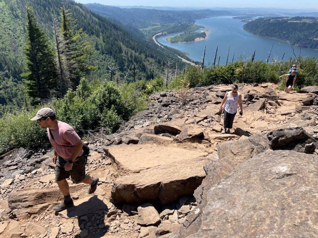
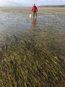
Wildflowers aren’t the only seasonal visitors that start popping up in abundance all over the Columbia River Gorge at this time of year. The others are tourists — lots and lots of tourists. More than 3 million visit the Gorge annually, according to nonprofit group Friends of the Columbia Gorge, and many of them are seasonal wildflower lovers.
“Our wildflower friends are excited, just like us,” said Renée Tkach, the Towns-to-Trails manager for Friends of the Gorge. “We know people are coming because people are already here.”
It’s still winter, but public-land managers and organizations like Friends of the Columbia Gorge, which promotes both conservation and responsible tourism, are reporting that the annual onslaught of spring visitors is already out there, for better and for worse.
The better: Gentle enjoyment, even awestruck appreciation of that remarkable landscape, plus maybe a good meal and local microbrew to top it off.
The worse: Traffic congestion and clogged trailheads, trampled landscapes and litter, not to mention more frequent accidents and injuries.
To learn more
Ready Set GOrge: readysetgorge.com
Oregon Wildflowers (includes the Washington side of the Gorge): oregonwildflowers.org
Friends of the Columbia Gorge: gorgefriends.org
Washington State Parks: parks.wa.gov
Oregon State Parks: stateparks.oregon.gov
Columbia Gorge National Scenic Area (U.S. Forest Service): fs.usda.gov/crgnsa
Waterfall corridor car permits: oregon.gov/odot/waterfall-corridor-permits
Dog Mountain permits: recreation.gov
Columbia Gorge Express (Oregon side): ridecatbus.org/columbia-gorge-express/
Skamania County Transit (Washington side): gorgetranslink.com
Webinar
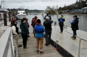
Tourism, accessibility and diversity in the Gorge — a webinar: A live March 30 webinar from Friends of the Gorge will discuss new trails, upcoming public-transit opportunities and the need for better access to the great outdoors for different communities. Emily Reed of the Columbia Gorge Tourism Alliance and Dez Ramirez of Wild Diversity will speak.
The webinar is set for 6 p.m. March 30. Register at: https://gorgefriends.org/news-events/events/2022-03-30/exploring-recreation-representation-in-the-columbia-gorge.html.
Fortunately, the internet has caught up with the Gorge, providing all the real-time resources you need in order to decide how, when and where to go. They’ll help you plan an outing that stays inside your personal Goldilocks Zone: not too hard but not too easy, not too close but not too far, a Gorge visit that’s just right.
Online previews
Your first planning stop should be ReadySetGOrge.com, a clearinghouse maintained by local partner agencies. ReadySetGOrge offers complete information — maps and directions; trail lengths, elevations and difficulty levels; facilities and required passes — for all 181 recreation sites in the Gorge.
Crucially, ReadySetGOrge tracks all those sites in real time, featuring updates about site closures and weather conditions. That way you can preview what it’s really like out there and avoid fingers-crossed pilgrimages into the unknown that end up being no fun at all because the otherwise lovely landscape happens to be gloomy, chilly or wet that day.
A few cameras perched here and there in the Gorge let you can see for yourself, Tkach said.
“It may raining in Portland, but is it raining in The Dalles? It might just be sunny and glorious,” she said.
Wildflower fans are also advised to visit Oregonwildflowers.org, created and maintained by flower superfan and photographer Greg Lief. Don’t let the misleading name fool you; Oregonwildflowers.org covers both sides of the Columbia River Gorge.
The exhaustive site collates recent trip reports from wildflower wanderers. Follow links to discussion groups and “up to the minute bloom conditions” from people who know, as well as links to further information including handy wildflower databases and local plant lists. OregonWildflowers.org also notes which sites are dog-friendly.
Take the bus
Tkach is an advocate for reducing congestion, pollution and frustration by improving public transit service between the Gorge and its fans in the metropolitan area. At this point, she said, that service still serves Portland better than it does Clark County.
Columbia Gorge Express bus service starts at Portland’s Gateway Transit Center and connects visitors with 17 trailheads along Interstate 84 on the Oregon side, including Multnomah Falls, Rooster Rock and the Pacific Crest Trail at Cascade Locks.
On the Washington side, you can pick up Skamania County transit at the Fisher’s Landing Transit Center in Vancouver and ride east to several trailheads, including the Washougal Waterfront Trail. The route goes as far as Stevenson.
Tkach said there’s another reason why public transit service into the Gorge is important and must be improved: equity.
“Not everyone has a car,” she said. “It’s been great to start providing a service to people who have no other way of getting out to the Gorge.”
Dog Mountain permits
A Dog Mountain shuttle from Stevenson is still uncertain for this year, Tkach said. But parking and hiking permits at Dog Mountain — another supremely popular, super-steep wildflower climb — are still required during maximum wildflower season, April 23 to June 23.
“That’s really helped with congestion issues. It’s nice to see a system working for people,” she said.
Waterfall corridor
It’s a sign of the Gorge’s soaring popularity that permits will be required between May 24 and Sept. 5 to drive the 9-mile waterfall corridor of the historic Oregon State Highway.
There will be two timed entry points, at Bridal Veil Falls and Ainsworth State Park. Details won’t be finalized until May, but the permits are expected to cost $2.
If you want to visit Multnomah Falls only, you’ll only need a parking permit for that site, but beware, it’s the most-touristed spot in the whole Gorge.