QIN declares landslide risk emergency, will seek federal help
Published 3:30 pm Friday, January 29, 2021
The Quinault Indian Nation has declared a state of emergency due to ongoing landslide risks that threaten to cut off reliable road access to Taholah.
The action could help the tribe get funding and resources from federal agencies who could help determine the extent of the problem and possible solutions.
About 1,000 people live in Taholah and hundreds more commute to the village, which houses tribal government headquarters, police, fire and medical services and a local office of the Bureau of Indian Affairs.
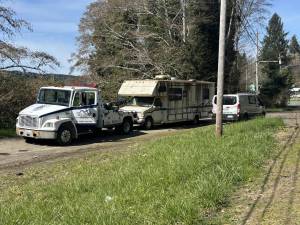
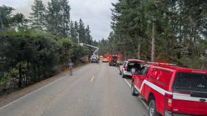
In December 2018, two separate landslides within days of each other, closed SR 109 and blocked access into and out of Taholah for several days. Highway 109 is the only maintained and paved road into the village and the southern portion of the Quinault Indian Reservation.
Of urgent concern, tribal officials said, is an area known as the “88 Corner,” about 1 mile south of Taholah where LiDAR mapping has revealed a slow-moving landslide that is blamed for cracked pavement on SR 109 and could lead to eventual collapse of the highway, a Quinault Nation news release said.
“Since time immemorial our lands have been subject to winter storms, flooding and landslides, but the increasing frequency and intensity of severe weather brought on by climate change means we need to be more proactive responding to problem areas before they turn into disaster areas,” said QIN President Fawn Sharp.
When SR 109 near the reservation is closed, the only means for entering or exiting Taholah is Bureau of Indian Affairs Road 29, also known as McBride Road, which is an 8.2 mile unpaved forest management road, which is often unpassable by passenger vehicles during periods of extreme weather.
The Quinault Nation hopes the emergency declaration will lead to technical and financial assistance to understand and address the risk of road collapse at 88 Corner, and additional landslides risks and disruption of access to Taholah and the Quinault Indian Reservation.
An immediate priority for the Quinault Nation, according to the news release, is to obtain updated LiDAR imagery of the 88 Corner and other problem areas along SR 109 and develop a plan to address landslide risks and maintain another reliable road route into and out of Taholah. LiDAR uses lasers to measure movement is sometimes used by geologists to study movement of land.
Numerous avenues are open to QIN to seek technical and financial assistance from the State of Washington and federal government, including U.S. Army Corps of Engineers, FEMA and the National Landslide Preparedness Act, which was passed by Congress and signed into law in early January.