
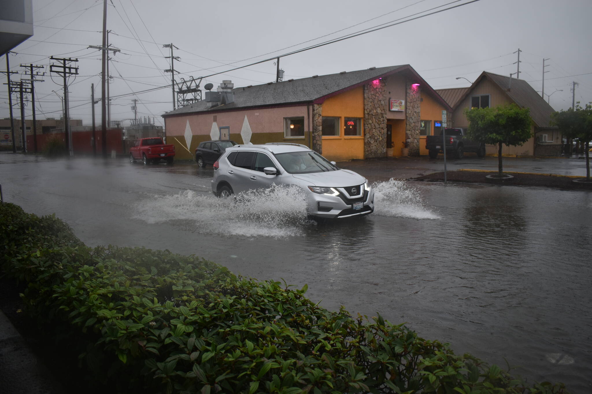
Western Washington’s first potent storm of the season pounded Grays Harbor with wind and heavy rain Friday, Nov. 4, leaving thousands in the county without power and swelling streets with stormwater.
The storm was the first of what’s projected to be a cool, wet winter in the region — a La Niña event — for the third year in a row.
Mary Butwin, a meteorologist with the National Weather Service, said an atmospheric river — a massive band of moisture coinciding with storm fronts — provided the storm’s moisture.
According to the National Oceanic and Atmospheric Administration, atmospheric rivers are crucial elements to the planet’s water cycle and are tied to both water supply and flood risks. Butwin said the events usually produce “wider-spread, heavier, and (more) persistent rain” than the average local rain event.
However, Butwin also said Friday’s storm was typical for an early November storm. Bowerman Airport in Hoquiam received roughly five inches of rain in a 48-hour period from Thursday morning to Saturday morning, according to weather service data.
“It’s a lot of rain, but it’s not unheard of, especially during this time of year,” Butwin said.
During that same time span, Butwin said most places on the Olympic Peninsula received 4-6 inches of rain, while some places in the Cascades received 6-9 inches.
While the quantity and timing of the storm’s precipitation was normal, a different seasonal factor — leaves — might have exacerbated flooding and power outages.
Deciduous trees’ annual shedding, Butwin said, can leave city streets and storm drains covered by fallen leaves, creating more standing water.
Stormwater submerged several Aberdeen streets Friday, covering curbs and sidewalks in some places. Franklin Field — which serves as a stormwater retention facility — filled with several feet of water. Stormwater spilled over the field’s southern wall, covered the sidewalk and leached into Market Street.
The brimming field even tempted one resident to wade in for a short swim.
But the early November season also means some leaves are still clinging to tree limbs, perhaps a greater threat, in the event of a storm, than leaves that have already fallen, according to Ian Cope, communications director at the Grays Harbor Public Utility District.
Cope said over 4,000 people across Grays Harbor County temporarily lost power because of Friday’s storm. A majority of the outages occurred near the coast and in the North Hoquiam area, stretching as far north as Taholah. In Aberdeen, about 200 people lost power near Arnold Hill.
Almost 1,400 people lost power near Elma-McCleary Road, which took the longest amount of time for crews to restore. Still, Cope said PUD crews restored all major outages by mid-morning Saturday, within 18 hours of the outage events.
Another 2,300 people lost power in the Westport area Sunday, but that was due to a car accident.
Cope said early-season storms usually produce a significant amount of damages and power outages. That’s because heavy rains soak lingering leaves on trees, making trees more likely to topple from fierce winds and cause damage to power lines. Fallen trees and branches caused most of the outages Sunday, Cope said.
Storm winds persisted between 25-32 miles per hour Friday afternoon, with gusts approaching 50 miles per hour, according to data from Bowerman Airport.
Coastal areas like Hoquiam are prone to high wind events, Butwin said, but Friday’s storm also brought high velocity winds to parts of Western Washington, such as the San Juan Islands, that don’t experience the events as frequently.
The storm left 190,000 people without power in Snohomish County, where a Grays Harbor PUD crew was dispatched after working through the night to restore local power outages.
“As part of the mutual aid agreements the PUD has, our crews are some of the most sought after in times when extra crews are needed,” Cope said.
Power outages might be less severe once trees drop their leafy extra weight, but Butwin said more storms are on the way.
“We’ll likely see more this month, and certainly within the winter,” Butwin said.
Meteorologists are predicting — for the third year in a row — that this year’s winter will be cooler and wetter than an average year. La Niña, however, “doesn’t necessarily equate to the number of storms or intensity of storms, it’s just the overall average for the season,” Butwin said.
A three-peat La Niña is rare — it’s only occurred twice since 1950, according to a recent study led by Robert Wills, an atmospheric scientist at the University of Washington. Not only is the event’s repeating frequency rare, the study says, but the recent uptick in La Niñas could be ruled by climate change. In coming years, that trend could soon flip, giving El Niño — La Niña’s dry, mild counterpart — the upper hand.
“The Pacific Ocean naturally cycles between El Niño and La Niña conditions, but our work suggests that climate change could currently be weighing the dice toward La Niña,” Wills told UW News in an early-October article. “At some point, we expect anthropogenic, or human-caused, influences to reverse these trends and give El Niño the upper hand.”
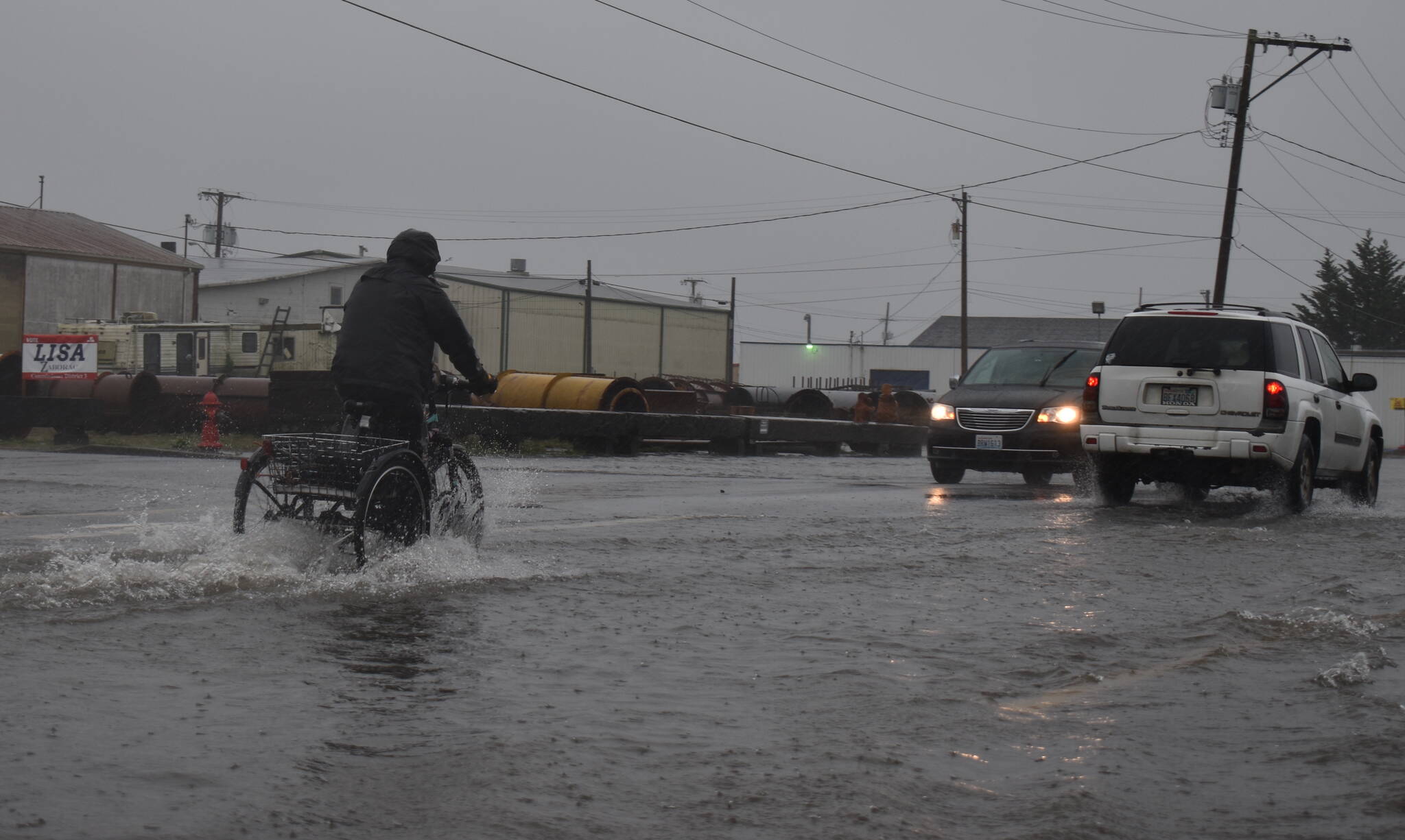
Clayton Franke / The Daily World A biker rides through several inches of water on State Street in Aberdeen.
