
The rapidly changing weather forecast now calls for cold conditions, but not as cold as previously forecast, according to the National Weather Service.
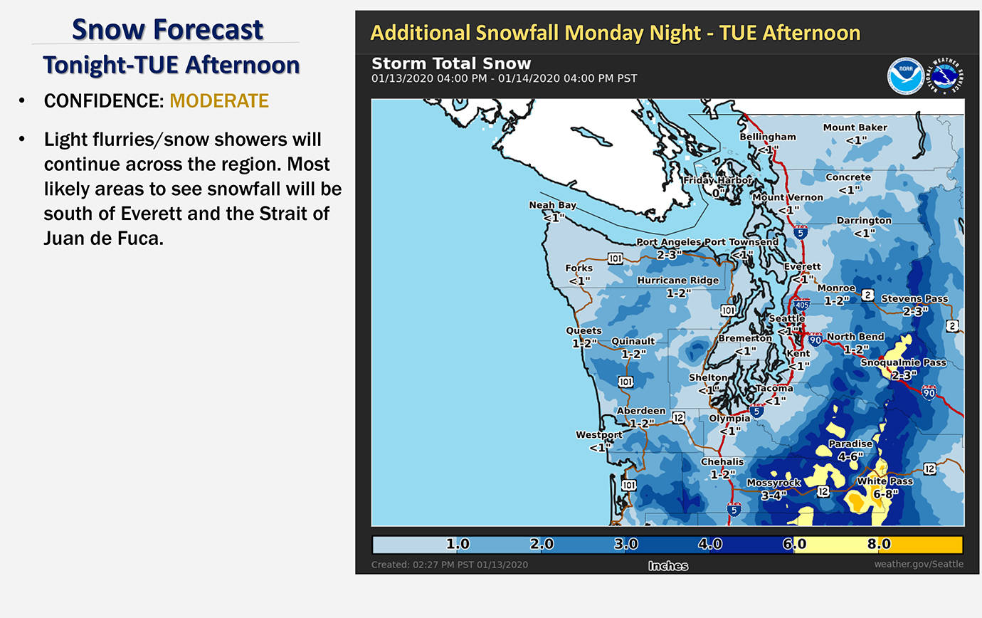
Tonight will bring lows around 29 degrees in Hoquiam, with a 60% chance of precipitation, but little, if any, snow accumulations. Rain and snow is likely during the day Tuesday, with snow accumulations of less than a half inch possible and a high around 36.
The winds pick up Monday night, with east winds 13-17 mph and gusts to 22 mph, picking up a little into Wednesday to gusts nearing 30 mph. From Wednesday afternoon through Thursday morning, gusts could hit 45 mph in Westport and 30 in Aberdeen, dropping overnight wind chill temperatures to 19 in Westport and 17 in Aberdeen.
The Weather Service said its snow forecast later in the week is still iffy. The forecast calls for less than an inch of snow in Westport, 1-2 inches in Aberdeen and 2-3 inches in Quinault total for the time frame between Wednesday night and Friday morning.
Temperatures will rise quickly on Friday, with overnight lows of 37 degrees in Westport and 33 in Aberdeen, rising to 44 and 42 degrees, respectively, by the afternoon. With the rapid snow melt and rainfall the Weather Service is monitoring the potential for some flooding into the weekend.
In Pacific County, there is a potential for new snow accumulation of about an inch overnight Monday and another half-inch Tuesday, according to the Weather Service. Wednesday brings the possibility of less than an inch of snow, with little or no snow accumulation expected for the remainder of the week. Wind gusts to 26 mph are possible in Raymond Wednesday and Thursday. The snow level is expected to climb to 900 feet on Thursday, with temperatures rising quickly and giving way to rain Thursday and into the weekend.
