Preparation continues for flood protection work in portions of Aberdeen and Hoquiam, residents were told during an informational event on Tuesday night at the Rotary Log Pavilion in Aberdeen.
The project, named North Shore Levee, is meant to provide the area long-term flood protection as well as change the flood insurance rate map — eliminating the requirement for flood insurance in the area where protection is improved.
The federal government could issue a Conditional Letter of Map Revision, which would allow the flood maps in Aberdeen to be changed if granted by the Federal Emergency Management Agency, making flood insurance rates go down for residents.
The North Shore Levee would include a dike starting along the Wishkah River in North Aberdeen, run south to the Chehalis River, and west along the Chehalis shoreline. Then it would continue north along the Hoquiam River and end up near the Little Hoquiam River.
“From Downtown Aberdeen to East Hoquiam,” said Mike Stringer, a planner and project facilitator with Maul Foster &Alongi, Inc.
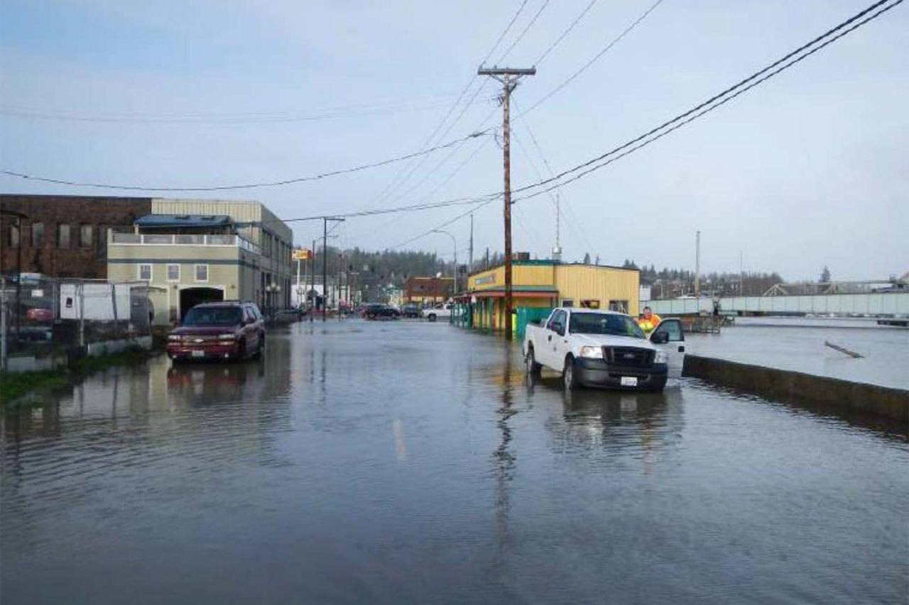
Infrastructure improvements would also help conditions during events that have caused flooding in both communities during the past with earthen dikes, floodwalls, raised roadways and pump stations. Stringer explained that the two cities are using outdated stormwater collection systems that are 80 to 100 years old.
“Now, there’s no place for the water to go,” he said.
Once completed, project consultants predict it will also benefit the area economically.
Cost for flood insurance has been on the rise because of major flood events in such areas of the country as Texas and Louisiana. Smaller communities across the country have taken the brunt of these increases.
“FEMA is running huge deficits,” Stringer said. “Communities such as yours are getting the short end of the stick.”
The work should also provide a boost to real estate because properties along the area’s riverfronts would be safer, thus more attractive to purchase because it would be easier for buyers to obtain financing than is the case now.
Nearly 2,100 flood insurance policies have been written in the area, as of 2014, that would be protected by the project.
The improvements should be able to handle future demand based on projections made by experts about how the area will be affected by global warming as well as meet FEMA specifications, according to Stringer.
And that is estimated to cause a significant rise in water levels by 2100, said Mark Steepy, lead engineer with KPFF Consulting Engineers in Lacey, which is working on preliminary design.
The levee is still being designed and that preliminary work should be completed early next year. Construction is scheduled to begin in 2018 and the goal is to complete work on the project in 2020.
Some floods are coastal-based and caused by extremely high tides, low pressure and wind. Others are referred to as “local” because of intense rain, local topography, high groundwater and stormwater system capacity are factors.
The most recent coastal flood in the area was in December 2015 while the latest local flood was in January 2015.
The next community meeting will be in November. By then, these most recent comments will have been fully evaluated and a preferred levee alignment selected.
Consulting property owners along the riverfronts is an important part of the project, especially as its alignment is being worked out by the consultants and the two city governments. People can get information about this plan by contacting northshoreleveeteam@kpff.com